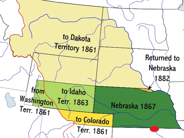
[Photo 1 – Nebraska Territory Map]
Homesteading in Nebraska
Introduction
The theme of Homesteading for the 2010 reunion at Doane College, Crete,
Nebraska, was announced at the 2008 reunion.
My husband and I suggested a presentation of homesteading about two of my Great
Grandfathers who homesteaded across the road from each other at Otoe County,
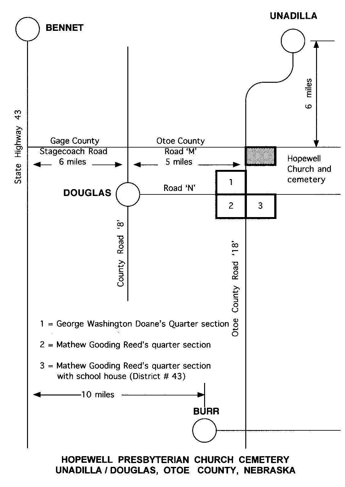
Nebraska - George Washington Doane and Matthew Gooding Reed. Their farms were
located one mile due south of Hopewell Presbyterian Church, and less than 40
miles east of Doane College. We suggested a tour to the area of the homesteads
and the church on the following day, and the reunion committee arranged the tour
to these areas including a reception at the Hopewell Church.
Matthew and Ruth Ann Reed's daughter, Jane, married Arthur, the son of
George and Frances Lucinda Doane. I was born at Edgar, Nebraska, and I graduated
from Harvard High School in Clay County.
Eunice Averill Brabec July, 2010
Part 1 Homesteading in Nebraska
[Photo 1 – Nebraska Territory Map]
PART I – INTRODUCTION
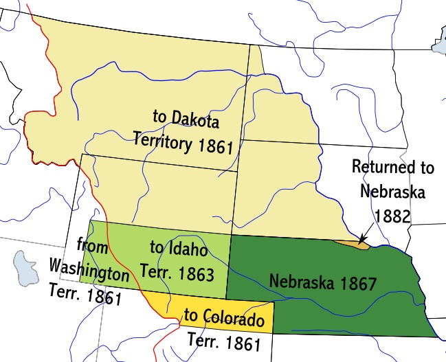
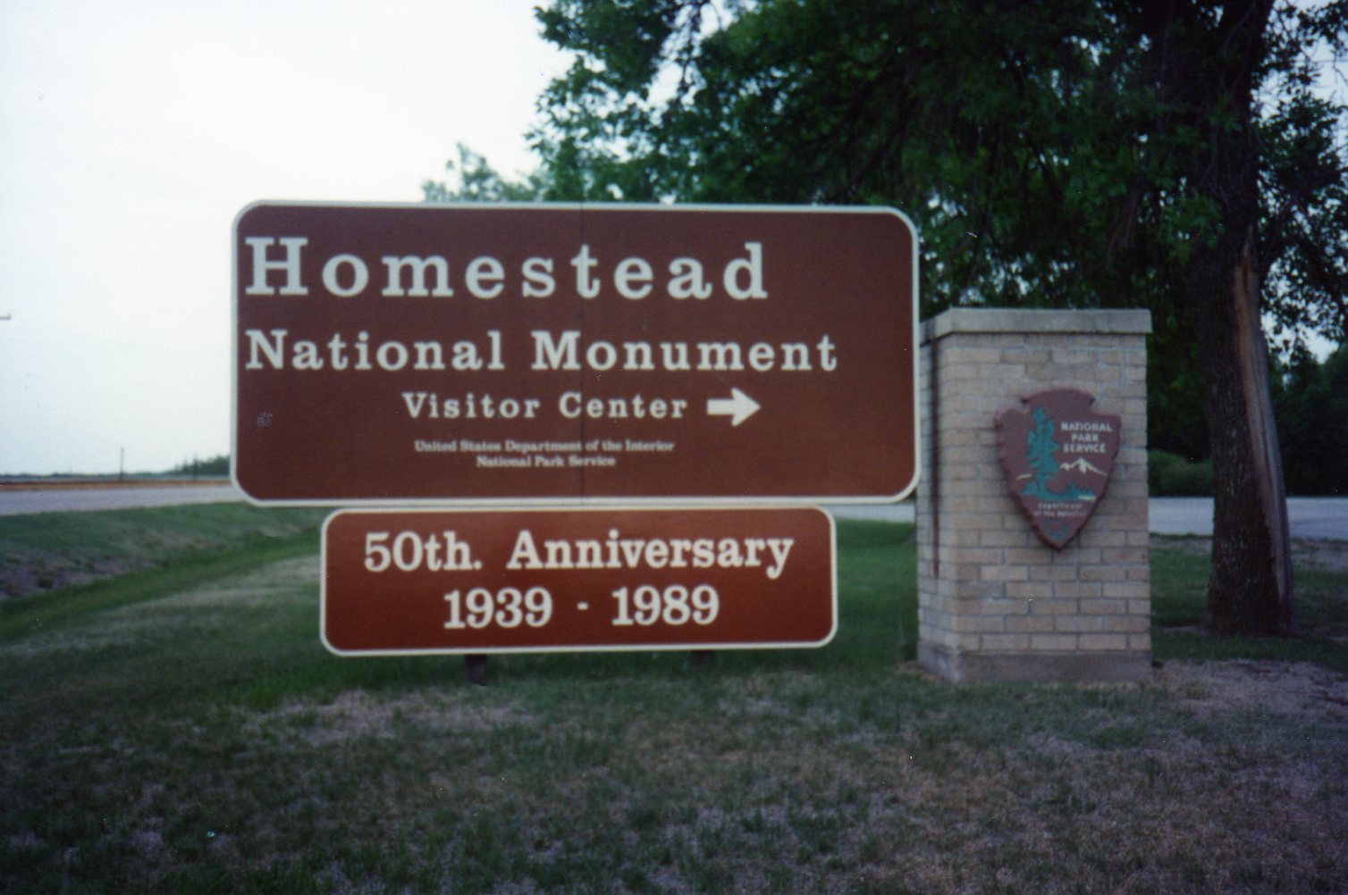
The Homestead Act is probably the most familiar of the various laws under which
public land was acquired in Nebraska. Its effective date was January 1, 1863,
and the Homestead National Monument near Beatrice, Nebraska, commemorates the
site for the “first” homestead.
The Homestead Act was designed to make land available "free" to those who would
live on and cultivate a tract for a period of time, usually five years. Though
the filing provisions were similar to the pre-emption requirements, there was no
per-acre payment required for the land itself. An individual meeting certain
requirements could claim up to 160 acres and not less than forty acres of
available public land.
What is pre-emption? –
definition of Bureau of Land Management
Some patents have the word "Pre-emption "in the upper left-hand corner.
"Pre-emption" was a tactful way of saying "squatter". In other words, the
settler was physically on the property before the Government Land Office
officially sold or even surveyed the tract, and he was thus given a pre-emptive
right to acquire the land from the United States.
[Photo 5 - Burlington RR (Nebraska State Historical Society)]
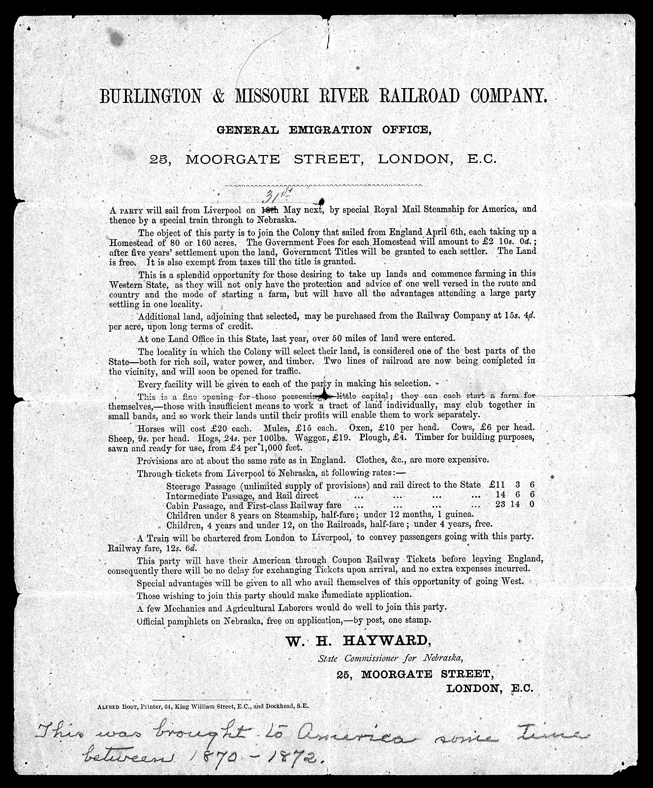
This notice was brought to the United States sometime between 1870 and 1872.
It reads in Part – “Burlington and Missouri River Railroad Company. General
Immigration Office. 25 Moorgate Street, London, E. C.
A party will sail from Liverpool on 31st May next, by special Royal Mail
Steamship for America, and thence by a special by train through to Nebraska.
The object of this party is to join the Colony that sailed from England, April
6th, each taking up a homestead of 80 or 160 acres. The Government Fees for each
Homestead will amount to 2-Pounds and 10 Shillings; after five years’ settlement
upon the land, the Government Titles will be granted to each settler. The land
is free. It is also exempt from taxes till the title is granted”. [The fee in
1873 was still $2.50 per acre or $400 for the standard 160 acres]
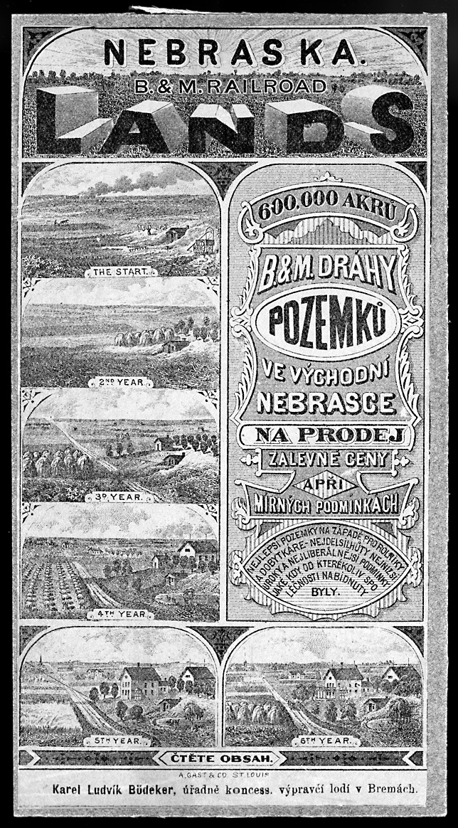
[Photo 6 - Czech Poster (Nebraska State Historical Society) ]
[Photo 7 – Year 1]

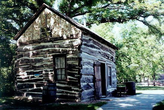
Year 1 – Live on the land and improve the land by building a 12 x 14 dwelling
and grow crops. A shelter protected from the elements – The “sod house” was
sometimes called a “mud house” or a “sod shack.” Generally it was of one low
story with a sod roof supported by timber.
A house built partly or wholly into a bank of earth was a “dugout”
Many pioneers built such a dwelling until they had the time and perhaps the
small amount of money to build a “soddie.” The floor, if not of earth, would be
of “scored logs” with the bark removed and made flat and “dressed with a broad
axe” to make them smooth.
[Photo 8 – Year 2]
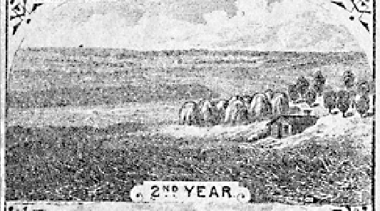
Year 2 – plant trees and grow crops.
[Photo 9– Year 3]
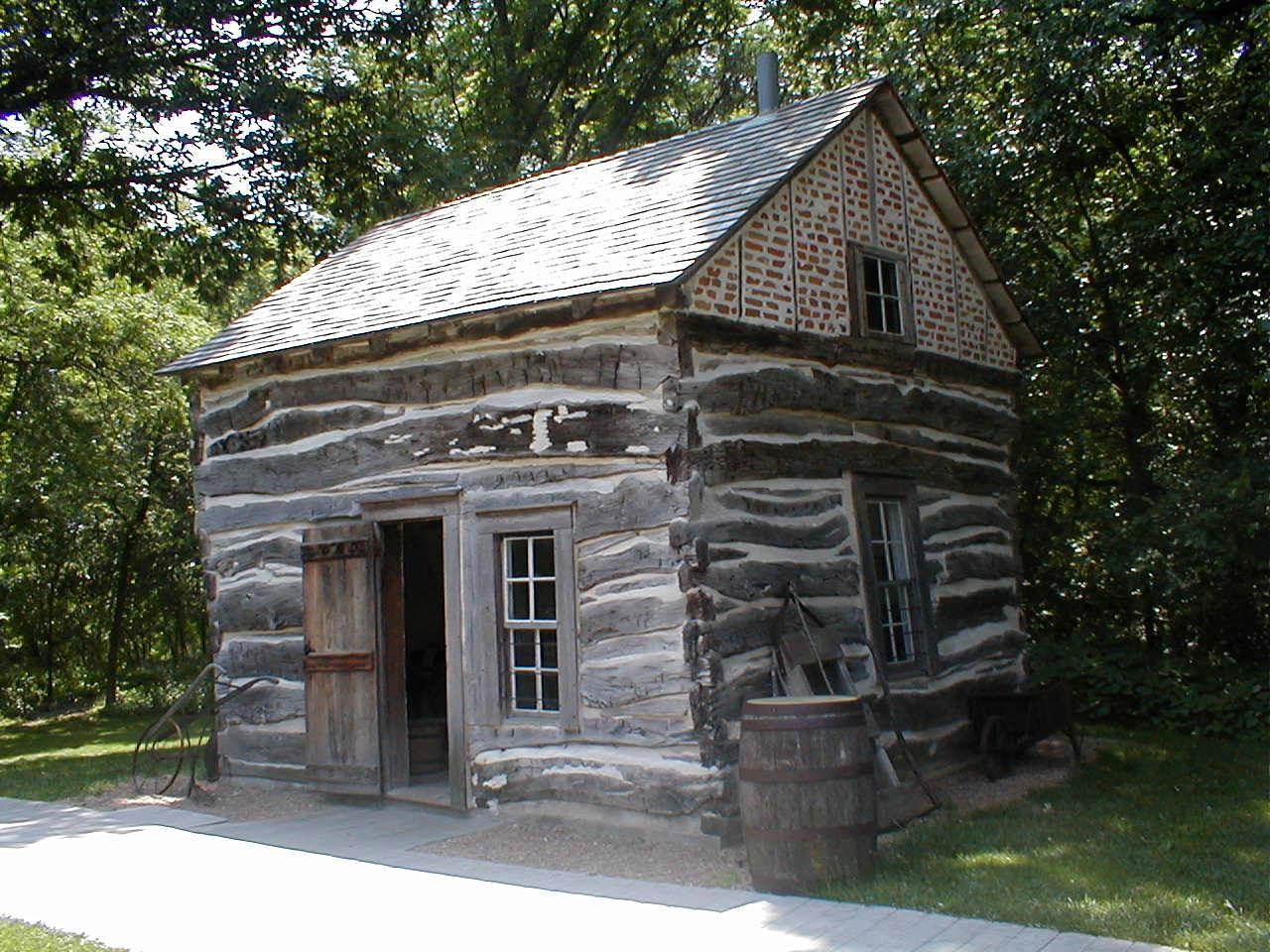
Year 3 – expand the tree and crop acreage and build a small house.
[Photo 10 – Year 4]
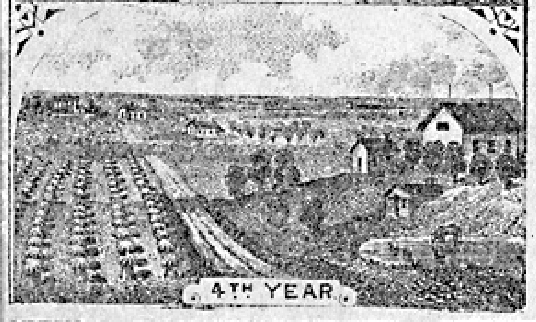
Year 4 – increased the agricultural acreage and built a barn.
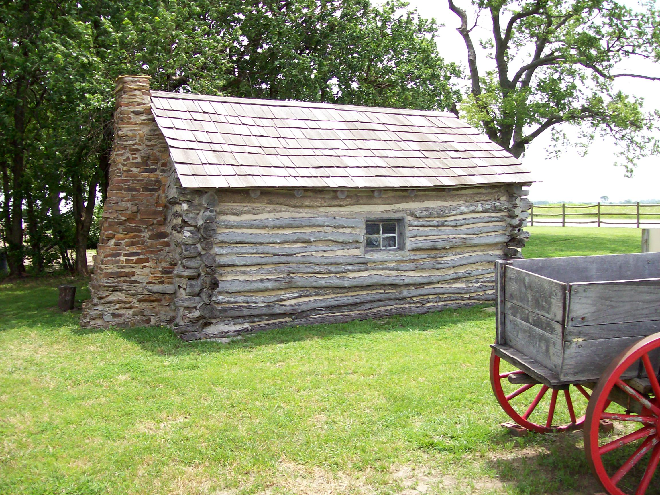
[Photo 11 – Year 5]
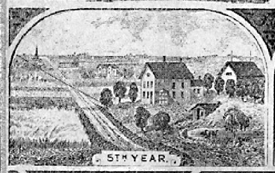
Year 5 - built a new, larger and comfortable house
[Photo 12 – Year 6]
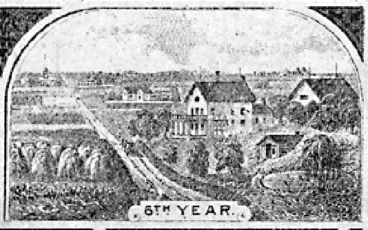
Year 6 - You had to live on the land for five years and could not abandon the
land for more than six months at a time. After the five-year period the
homesteader could file for a patent (or deed of title) by submitting proof of
residency and the required improvements to the local land office. If approved,
the land was yours for a small registration fee.
 (
(
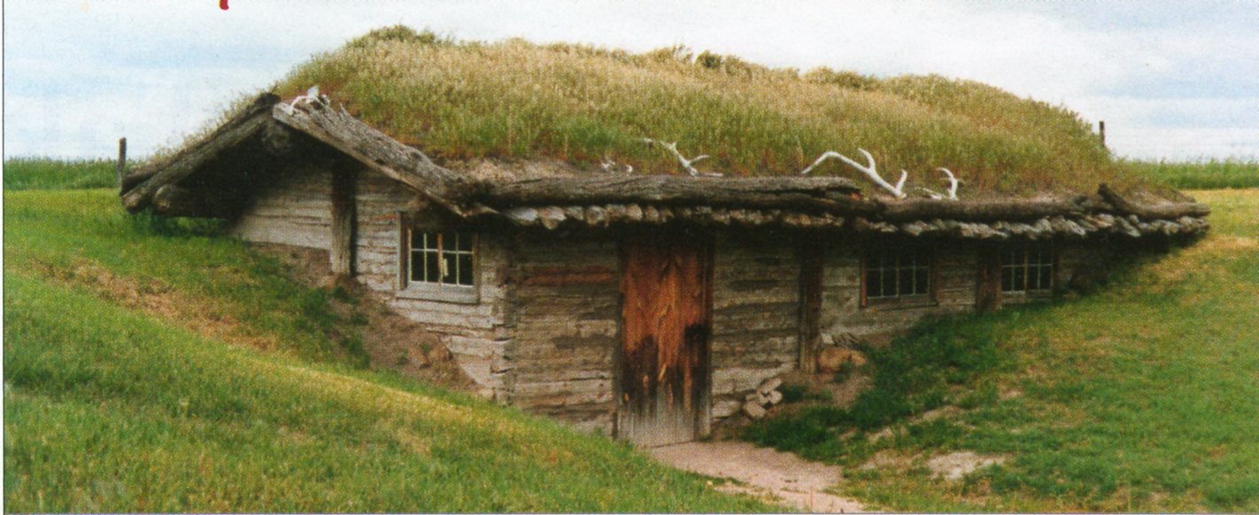
[Photo 13 – Nebraska Dugout, Chadron, NE (National Register of Historic Places]
James Bordeaux, an employee of Pierre Chouteau, Jr. and Company, established
this small trading house, near Chadron, in the winter of 1837-38. Bordeaux
maintained this post until 1872 and carried on a successful trade with the Brule
Sioux Indians. The site includes two reconstructed buildings, a combined trading
house and living quarters, and a small warehouse.
[Photo 14 - Reed Dugout, Otoe County, Nebraska, 2004]
%202003.JPG)
[Photo 15 - Aksamit Homestead, Nebraska]
[Photo 16 - Little House on Prairie, southeastern Kansas, 2007]
[Photo 17 - Little House on Prairie, southeastern Kansas, 2007]
[Photo 18 – D.A.R. House, Washington, Iowa, 2007]
It has been estimated approximately 40 percent of the homestead applicants
eventually fulfilled all the requirements of the government and earned title to
their property.
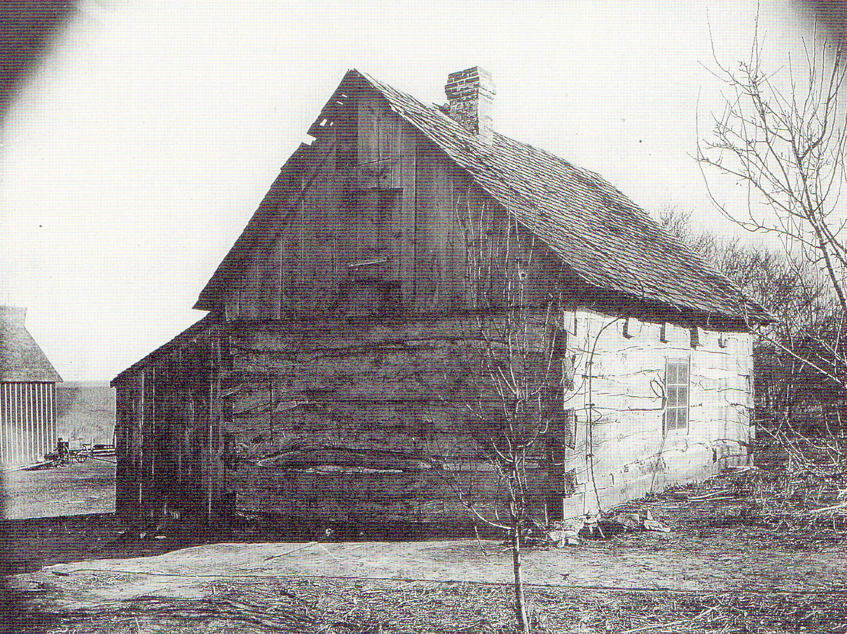
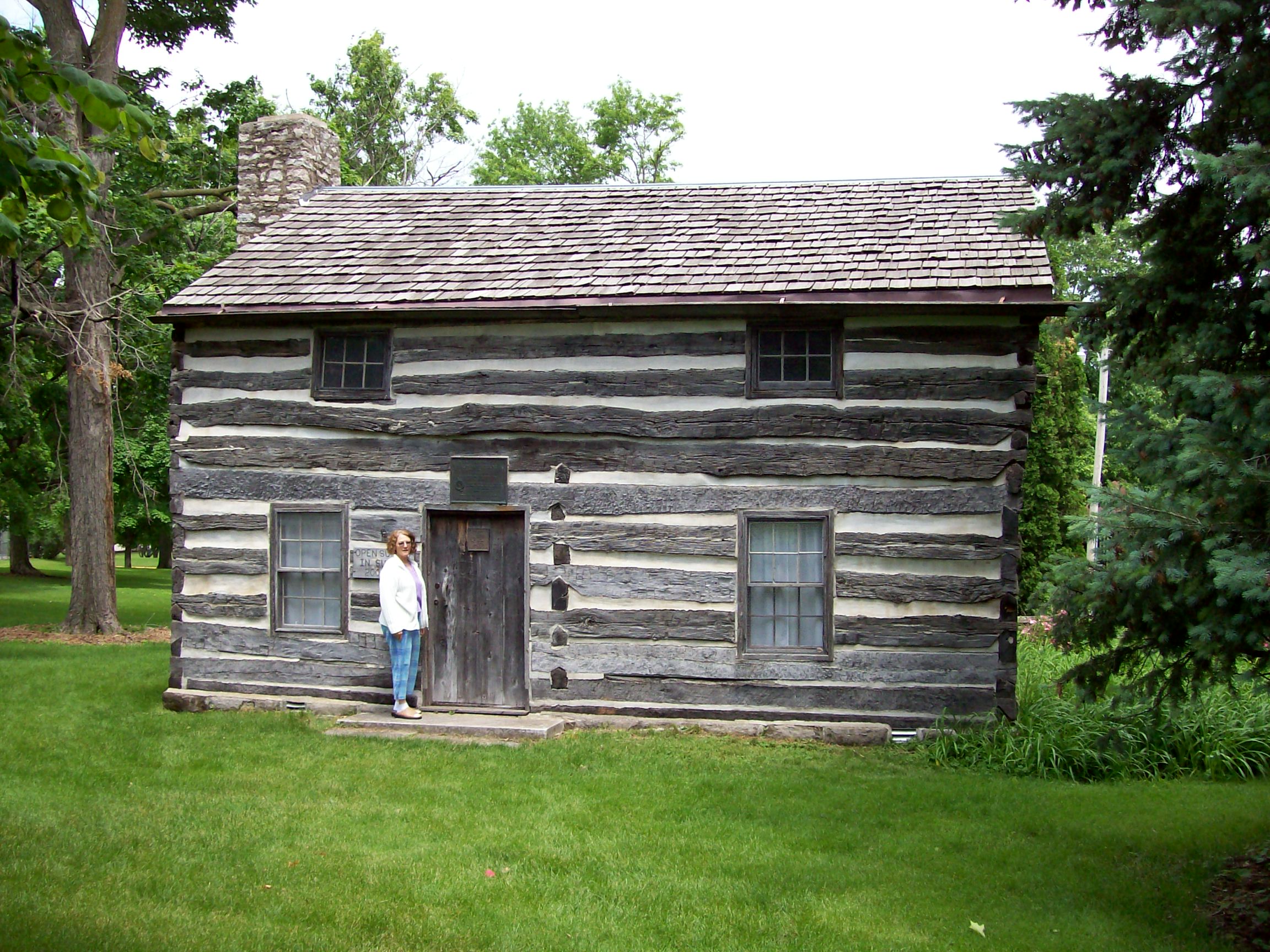
[Photo 19 – Palmer – Epard Cabin]
[Photo 20 – Palmer – Epard Cabin]
Starting with the annexation of the Northwest Territories and the State of Ohio
and extending to the Pacific Ocean Townships and Ranges were created in order to
easily locate one’s land grant or property acquisition.
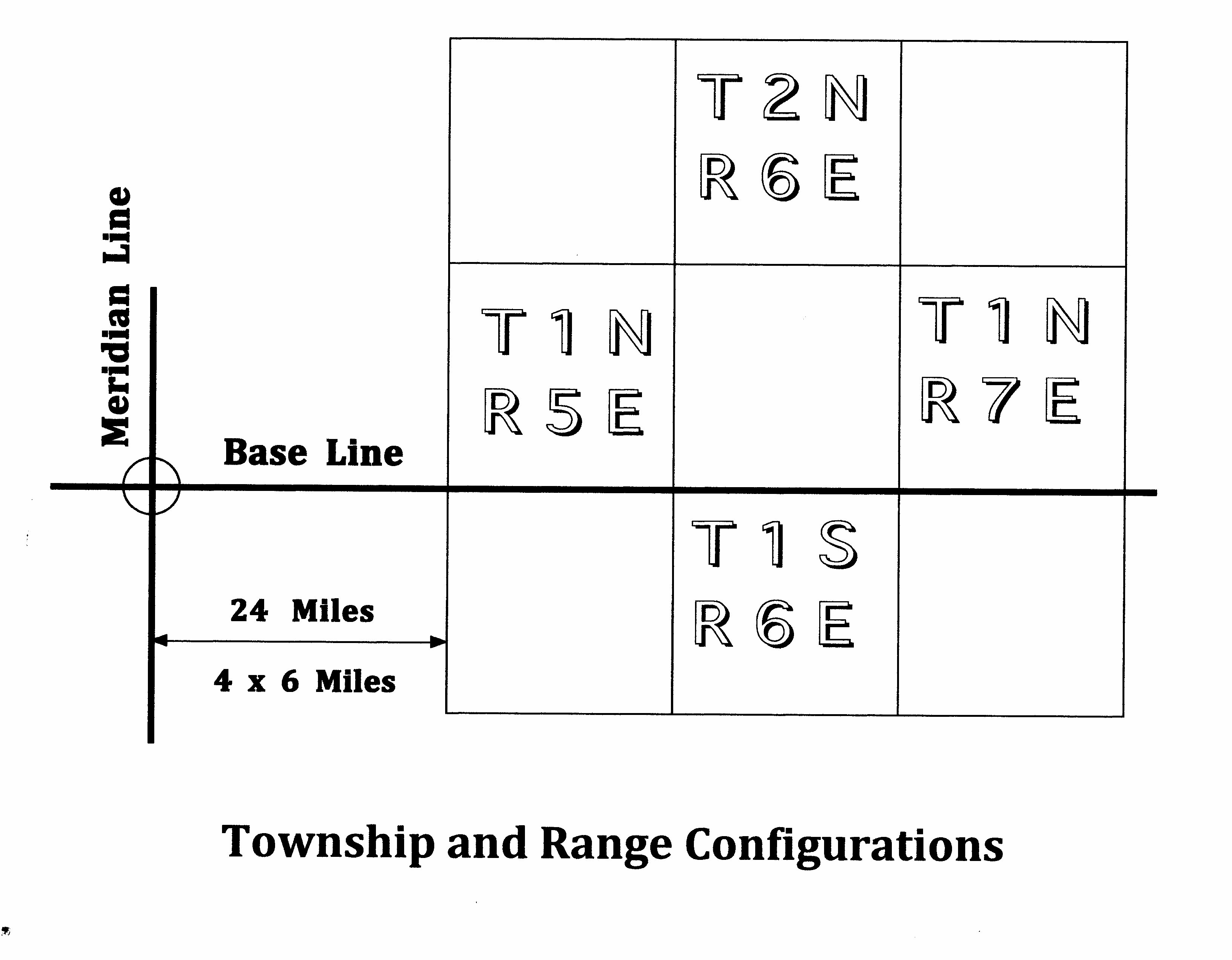
[Photo 22 – Township and Ranges]
Townships are six-miles square and are either North or South of a base line.
Ranges are either East or West of a principle meridian. For example: Township
Two North, Range Six East, Mount Diablo Base and Meridian.
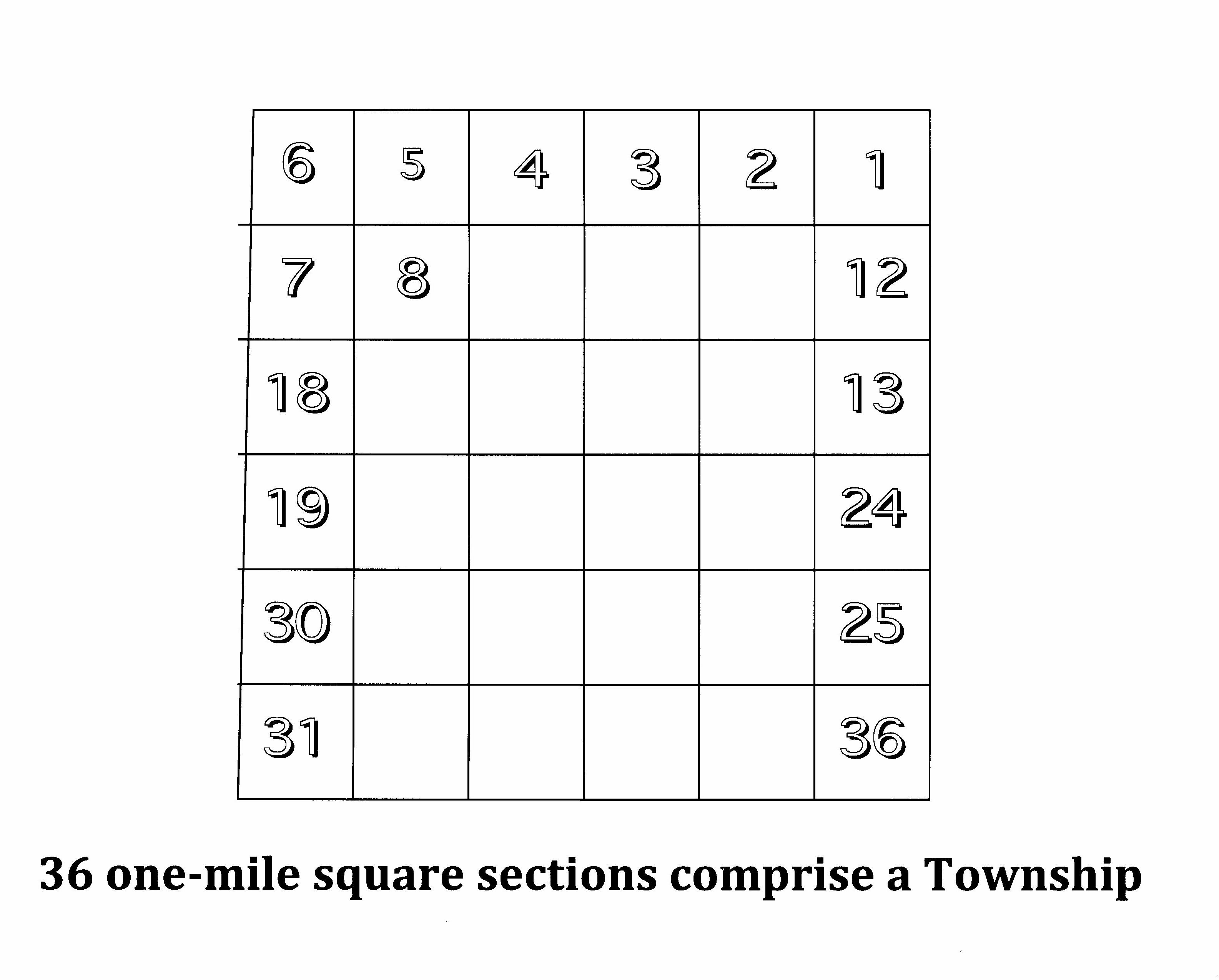
[Photo 23 – Township map]
A Township is composed of 36 mile-square sections.
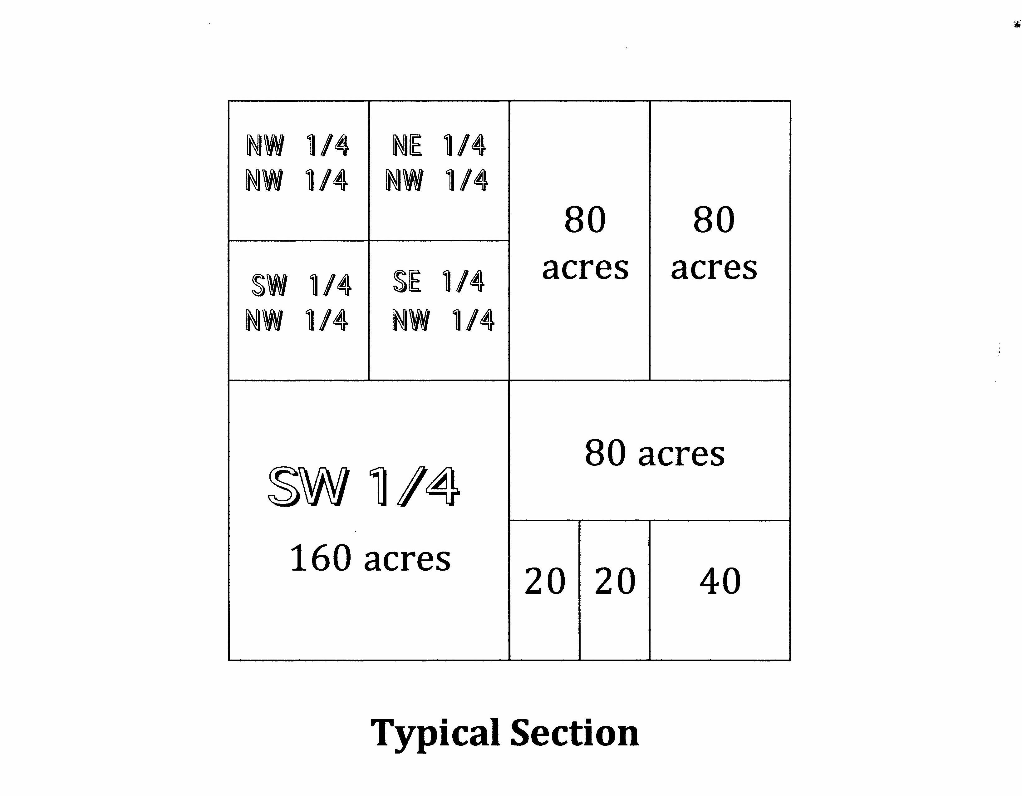
[Photo 24 – Section Illustration]
A Section is one mile square. A quarter section equals 160 acres. Land can be
obtained in any square or rectangular shape, and it does not have to be located
in the same section or Township.
[Photo 25– Mahaska marker]
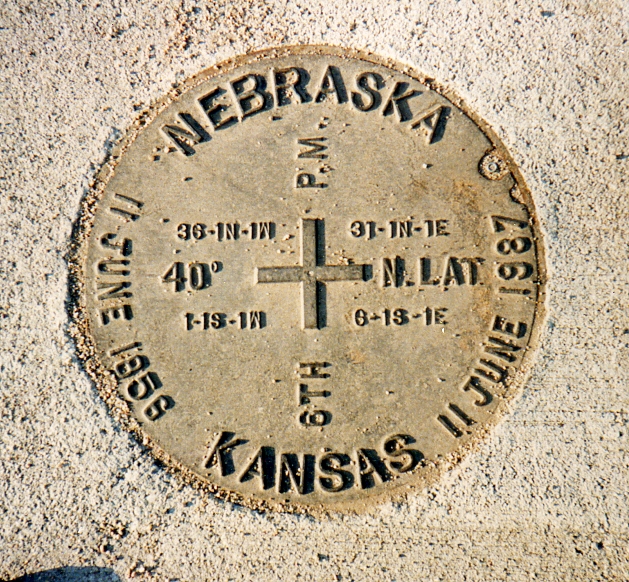
On the Kansas-Nebraska border in north central Kansas is located the surveyor's
benchmark from which all property in Kansas, Nebraska, and parts of South
Dakota, Wyoming, and Colorado are referenced.
Soon after the passing of the Kansas-Nebraska Act in 1854, a survey was
commissioned by the US Government so that the lands newly opened for settlement
could be properly and legally plotted out for the homesteaders.† The survey was
carried out by Charles Manners who started by erecting a Cast Iron Monument on
the west bluff of the Missouri River in 1855 at 40 degrees North latitude--the
Northern boundary of Kansas.
[Photo 26 – Map location of marker]
From this point, he surveyed 108 miles west and placed a red sandstone marker at
the location of the 6th Principal Meridian. The imaginary line between these
two markers marked the border between the two future states. The original
sandstone marker is still intact under the manhole cover in the middle of the
road, though part of it has been carted of to the Kansas Museum of History in
Topeka.
[Photo 27 - Marker Information]
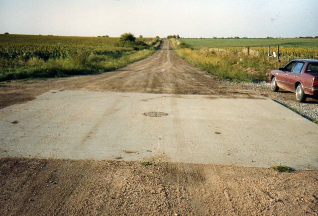
[Photo 28 - Marker cover]
Part 2 Mathhew Gooding Reed
And now to two gentlemen who successfully followed these instructions -
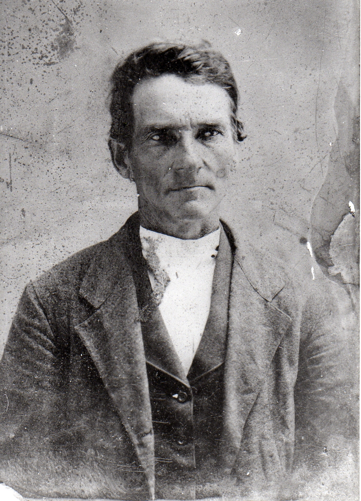
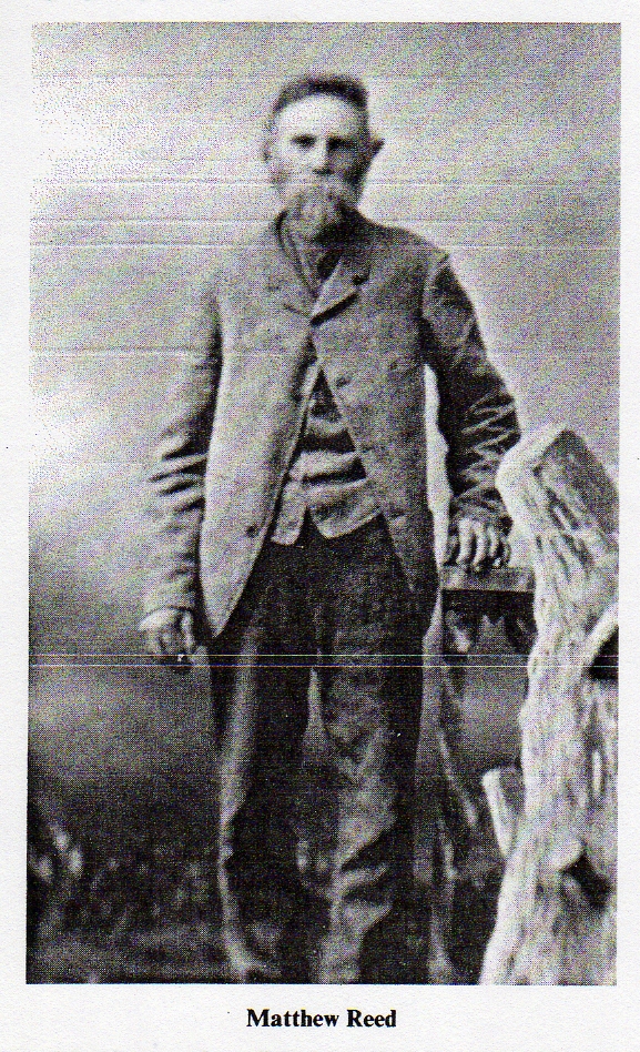
[Photo 29 - Mathew Gooding Reed about 50 years old]
FIRST - Matthew Gooding Reed was born on 31 October 1831, near Marysville, Union
County, Ohio. He was the first of ten children. His parents and grandparents
removed from Fayette County in southwestern Pennsylvania in 1800.
Matthew Gooding Reed was named after Matthew Gooding, a neighbor and friend of
the family, who was a Justice of the Peace 1829 - 1831.
Matthew removed in 1856, at age 25, to Washington County, in southeastern Iowa.
Here in Clay Township he taught school. The first school in Brighton was held in
a log house in the east part of town in 1840. The first schoolhouse was erected
the following year in the west part of town. It cost the town nothing as the
whole neighborhood turned out to help for the public good.
One of his students was Ruth Ann Smith. Ruth Ann was born on 04 April 1842, at
Westfield, Hamilton County, Indiana, just north of Indianapolis. Ruth Ann, with
a long ancestry of Quakers, married Matthew on 20 March 1859, at Brighton
Township, Washington County, Iowa.
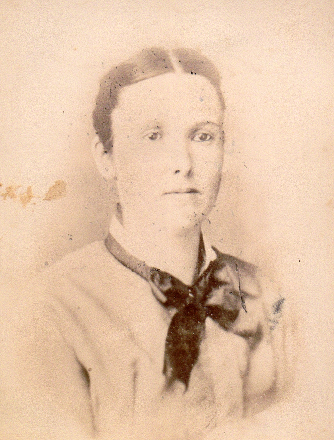
[Photo 30 - Ruth Ann Smith Reed]
They had fourteen children between 1860 and 1881. The first was born in
neighboring Keokuk County, Iowa, but the second, Jane Reed [Eunice’s Great
Grandmother], was born on 06 February 1862, Hastings, Mills County, Iowa. All
the remaining children were born at Otoe County, Nebraska.
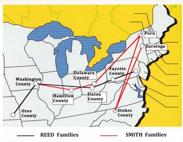
[Photo 31 – Reed-Smith Migration]
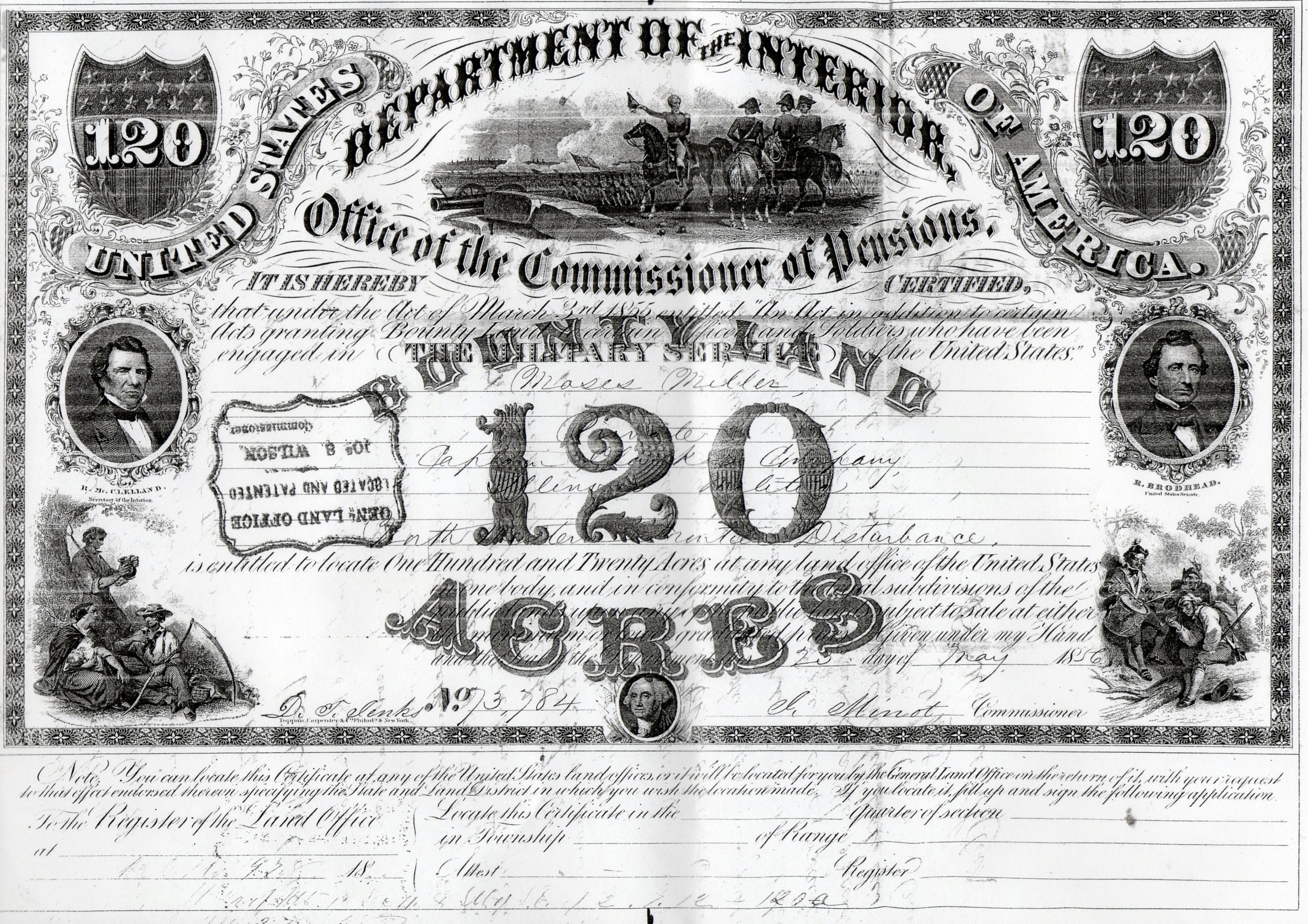
[Photo 32 – Military Bounty Certificate]
However, on 29 Mar 1858, Mathew secured a Military Bounty certificate, No.
73,784, for 120 acres of land from Moses Miller of Keokuk County, Iowa. Later,
on 27 Aug 1858, Matthew filed the Military Bounty right on 120 acres in Sections
11 and 2, Township 7, Range 12, which was located at Delta (now Lorton) in Otoe
County, Nebraska.
This certificate for land was originally awarded to Private Captain Moses Miller
for his service with the Illinois Militia in the North Western Frontier
Disturbance of the Black Hawk Indian War. Military Warrant Acts granted public
land to soldiers instead of pay.
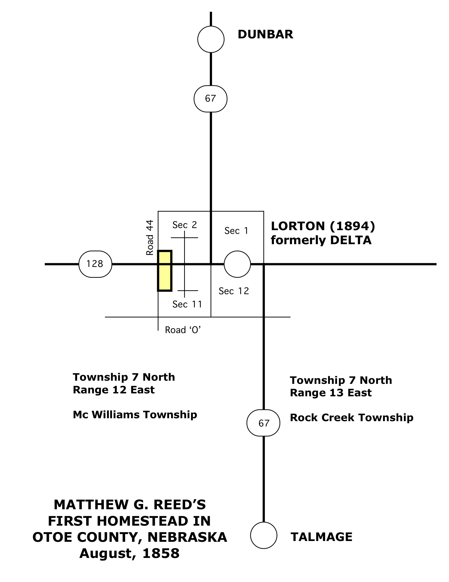
[Photo 33 – Location map of patent of 1858]
[Photo 34 – Affidavit of neighbor]
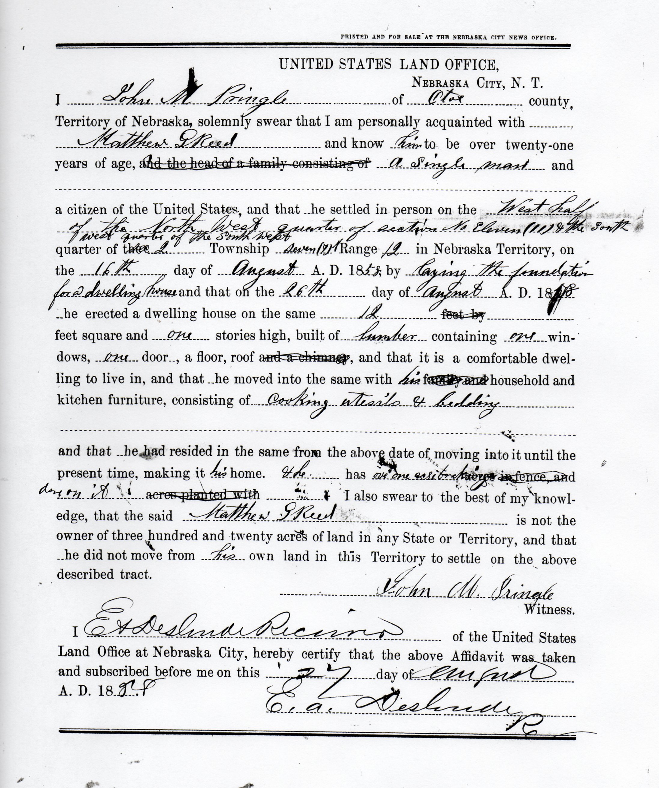
AFFIDAVIT OF FRIEND OR NEIGHBOR
I, John M. Pringle, of Otoe county, Territory of Nebraska, solemnly swear that I
am personally acquainted with Mathew G. Reed and know him to be over twenty-one
years of age, and the head of a family consisting of a single man and a citizen
of the United States, and that he settled in person on the West half of the
North West quarter of section No. Eleven (11) & the South west quarter of the
South West quarter of the 2 Township seven (7) N [north] range 12 in Nebraska
Territory on the 16th day of August A.D. 1858, by laying the foundation for a
dwelling house and that on the 26th day of August A.D. 1858 he erected a
dwelling house on the same 12 feet square and one stories high, built of lumber
containing one windows, one door, a floor, roof and a chimney, and that it is a
comfortable dwelling to live in, and that he moved into the same with his family
and household and kitchen furniture, consisting of cooking utensils & bedding
and that he had resided in the same from the above date of moving into it until
the present time, making it his home. And he has over one section breaking in
fence and done on it acres planted with ____[not indicated]____. I also swear to
the best of my knowledge, that the said Mathew G. Reed is not the owner of three
hundred and twenty acres of land in any State of Territory, and that he did not
move from his own land in this Territory to settle on the above described tract.
John M. Pringle, Witness
After establishing his right to the land, he returned to Iowa to marry.
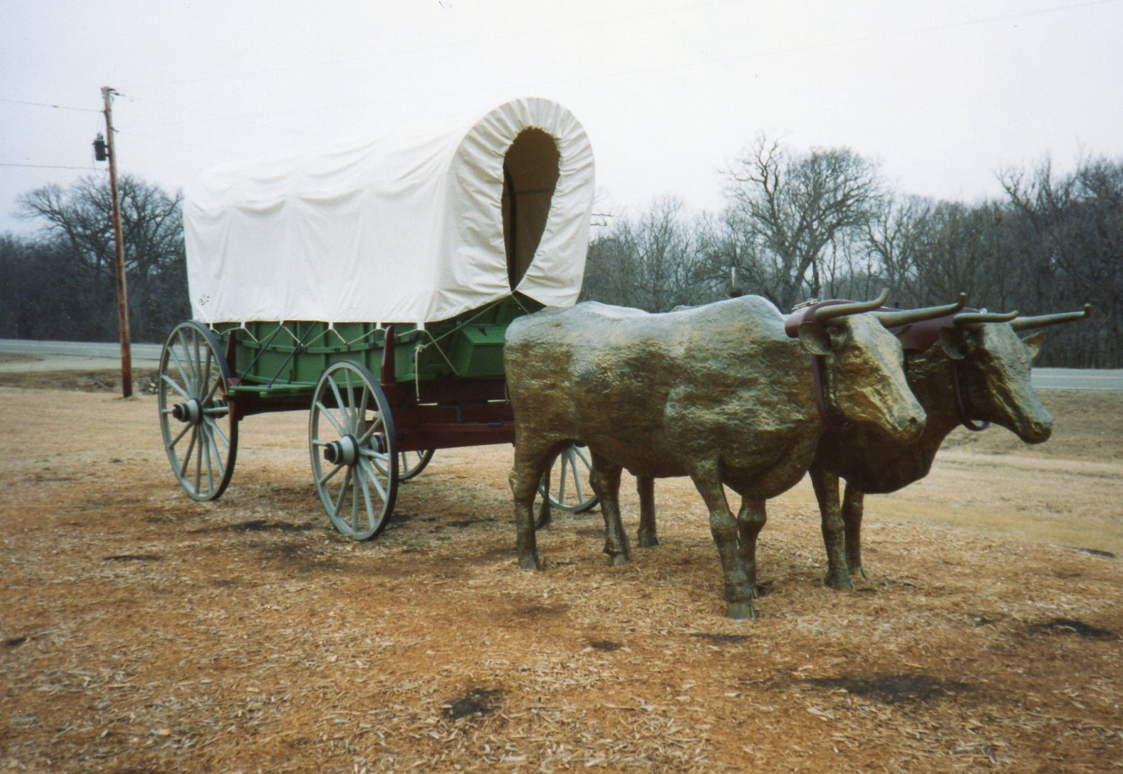
[Photo 35 – Wagon and oxen]
Matthew and Ruth Ann, with their two daughters and their covered wagon drawn by
their ox team, Dave and Darb, migrated to Nebraska in 1862.
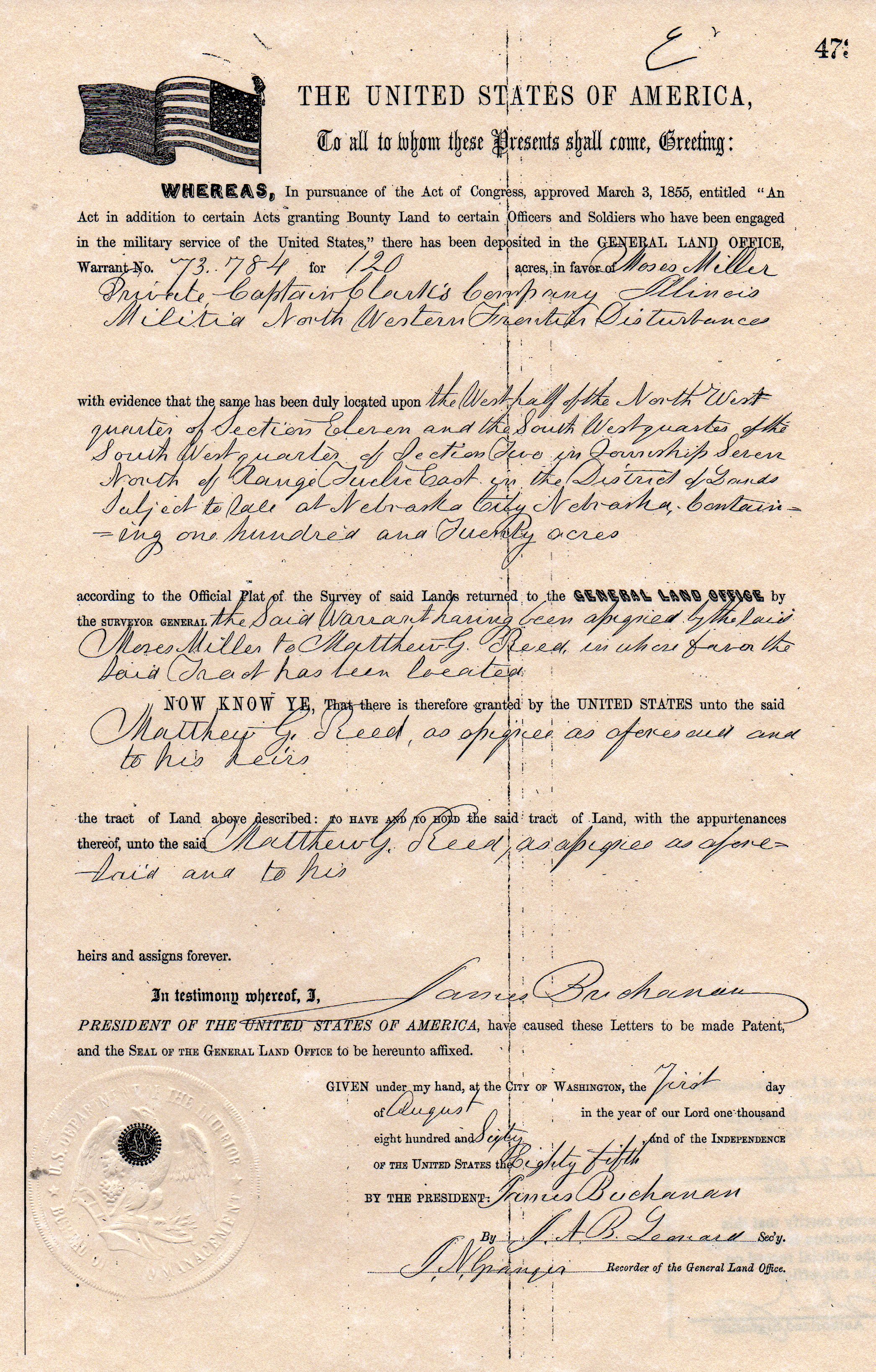
[Photo 36 - Land Patent (Bounty) of 1860]
Why they did not stay here is unknown. Maybe the land appeared better in the
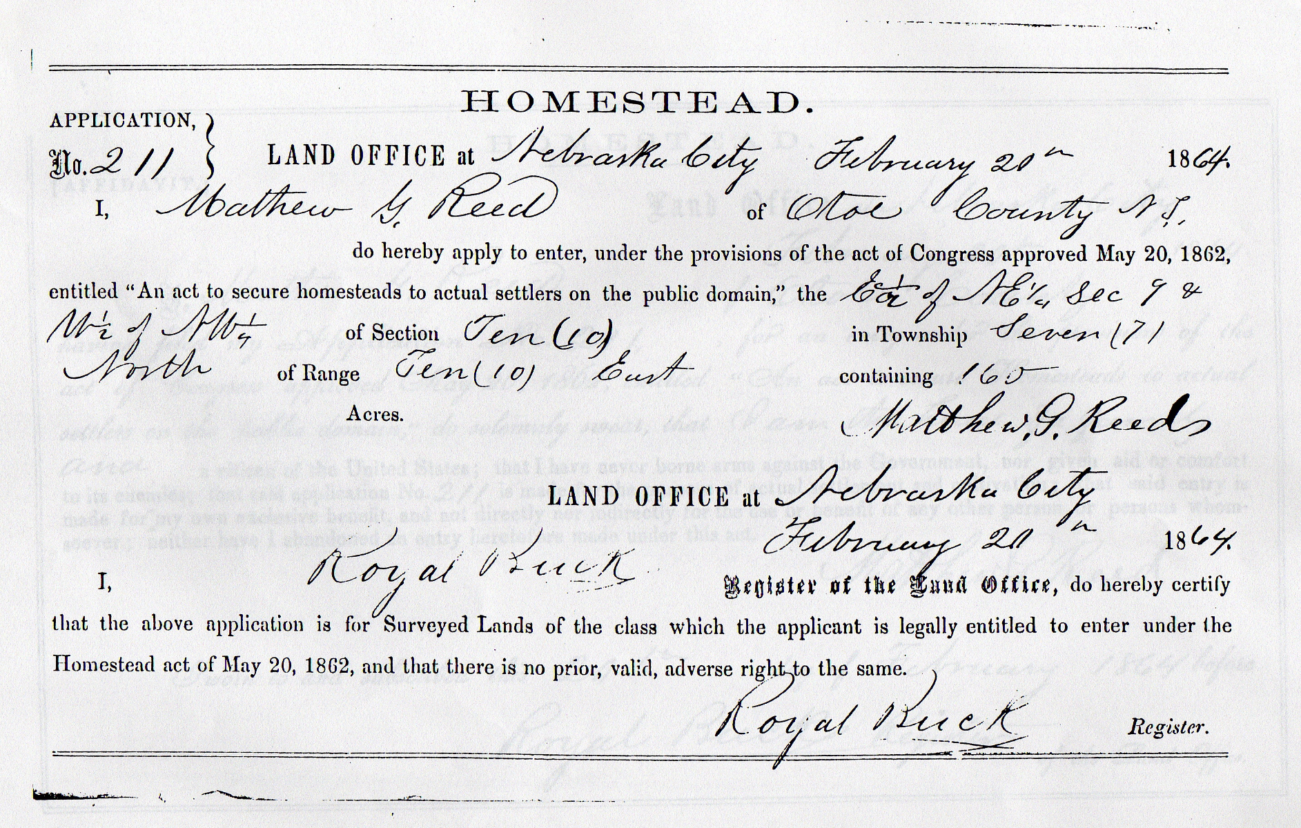
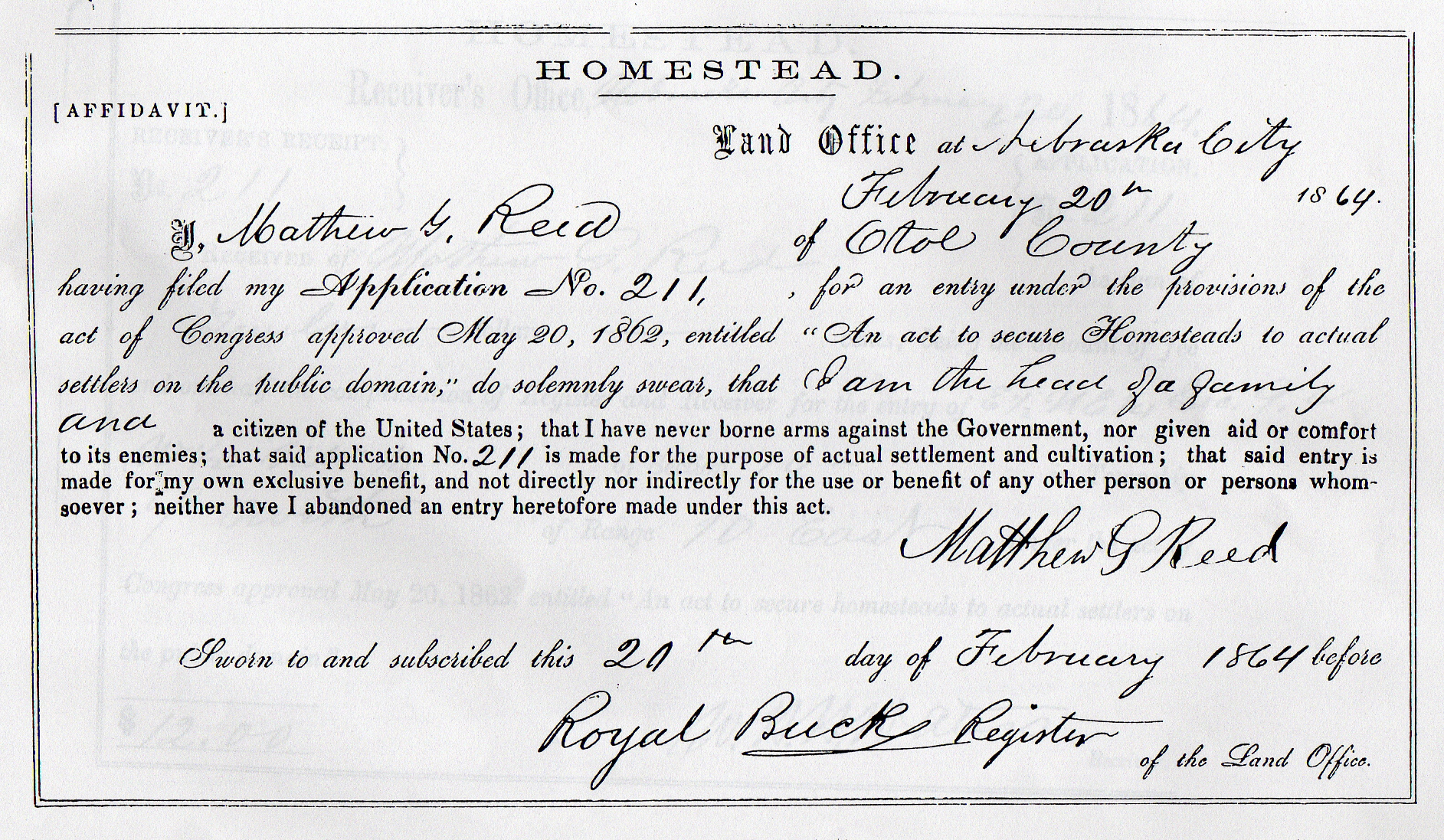
western part of the county. Again, on 20 Feb 1864, Matthew filed for 160-acre
homestead at Nebraska City Land Office.
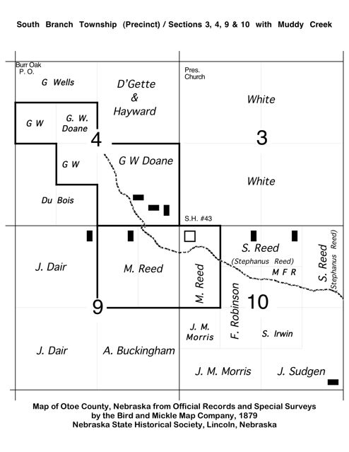
This homestead, 14 miles west of the first, was located, in Sections 9 and 10,
Township 7 North, Range 10 East, is located north of Burr in Otoe County, and
south of the Hopewell Church. The filing fee for Application No. 204 was $12.
This homestead is fourteen miles due west of their land at Lorton.
[Photo 37 – Homestead Application]
[Photo 38– Initial Affidavit]

[Photo 39 - Location Maps]
[Photo 40 – South Branch Township map with Location]
[Photo 41 – Aerial view]
During April 1864, they dug a room in the side hill and covered it with a
thatched roof to live in until they could afford a better house. The dugout also
had a loft. This dugout was later used as a cellar and more rooms built over it.
In 1862 he served as an election official. In October 1865 he was elected clerk
of election. In February 1866 Mr. Reed was appointed commissioner to lay out a
certain road and twice that year he served on the election board at two special
elections. In 1867 he served as assessor, as clerk of election and was appointed
several times to lay out certain roads.
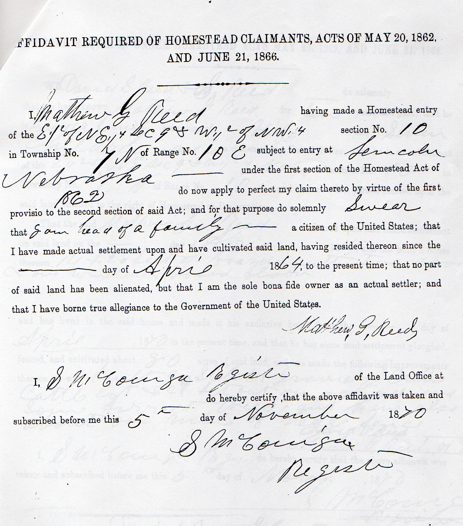
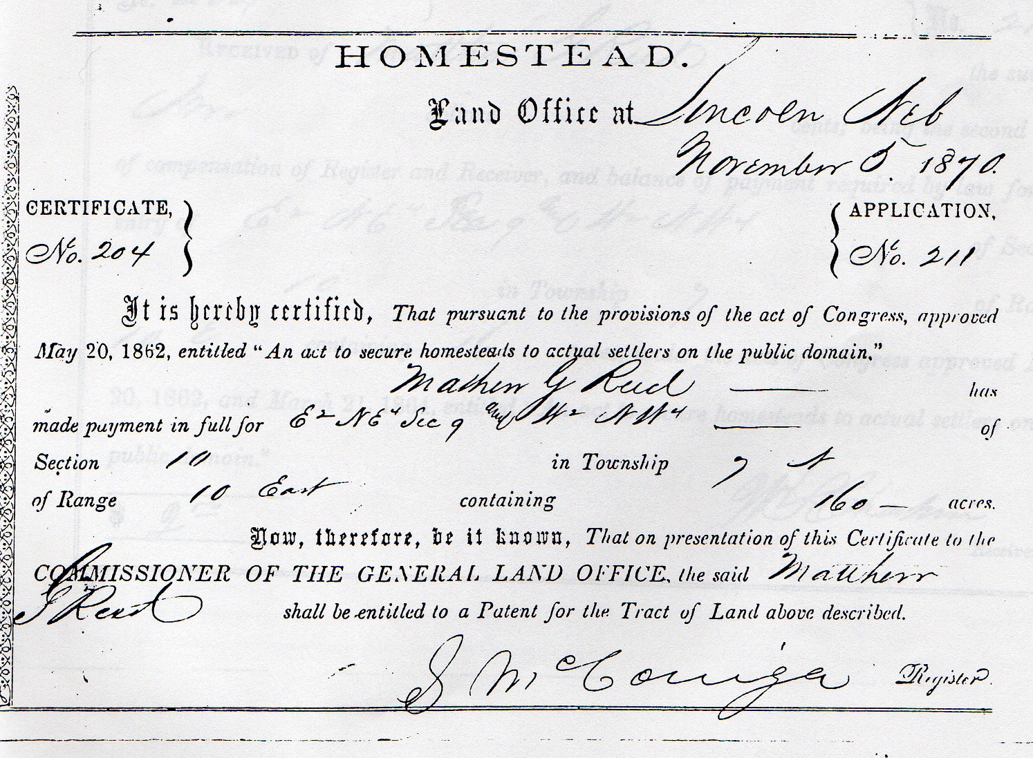
1870 he received his Patent for the homestead:
HOMESTEAD No. 204 - - 05 November 1870
PATENTED to Mathew G. Reed on 10 January 1873.
[Photo 42 - Proof]
[Photo 43 – Affidavit]
[Photo 44 – Certificate]
Mathew was a school teacher in 1871 for the salary of $120, 1872 at $90, 1873 at
$109 and 1874 at $105.
“The School District was not formed until four families had moved in. They were
the Matthew Reeds, the George Washington Doane family, the Wells family and the
Morris Family.
“The first teacher in this school was Sarah Davis, who later married and lived
in Unadilla. School board members were Matthew Reed, George Washington Doane and
J. Wells. Matthew Reed and J. Wells later taught in this school. Mr. Reed was a
well educated man having attended college in Ohio. He was surveyor of land for
the precinct.
“The first family school house built about 1880. It faced east. Benches were
built around the wall with a stove in the middle of the room. The land for the
building was donated by Matthew Reed.
The following story was related by Dora Henderson, another Reed descendant, to
Eunice Averill Brabec: Roy Reed, the 7 year old son of Matthew Gooding Reed had
accidentally been shot in the foot ca 1880. The doctor had been sent for but in
3 days time the boy was near death and no doctor had arrived. M.G. Reed had his
2 oldest daughters (Alice and Jane) give the boy brandy to drink until he was
very inebriated. The boy was then tied down and held by the daughters as the
father amputated his son’s foot. By the time the doctor arrived 2 days later Roy
was on the way to recovery. This took place in Otoe County, Nebraska, at the
Reed home. Jane was to become Eunice’s Great Grandmother.
[Photo 45 – Roadway view of Reed and Done Land]
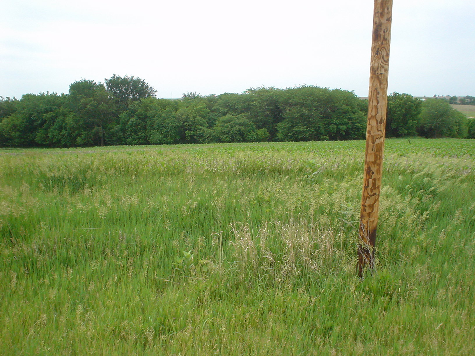
[Photo 46 - Reed homes were in the trees]
[Photo 47 – Dugout logs still visible]
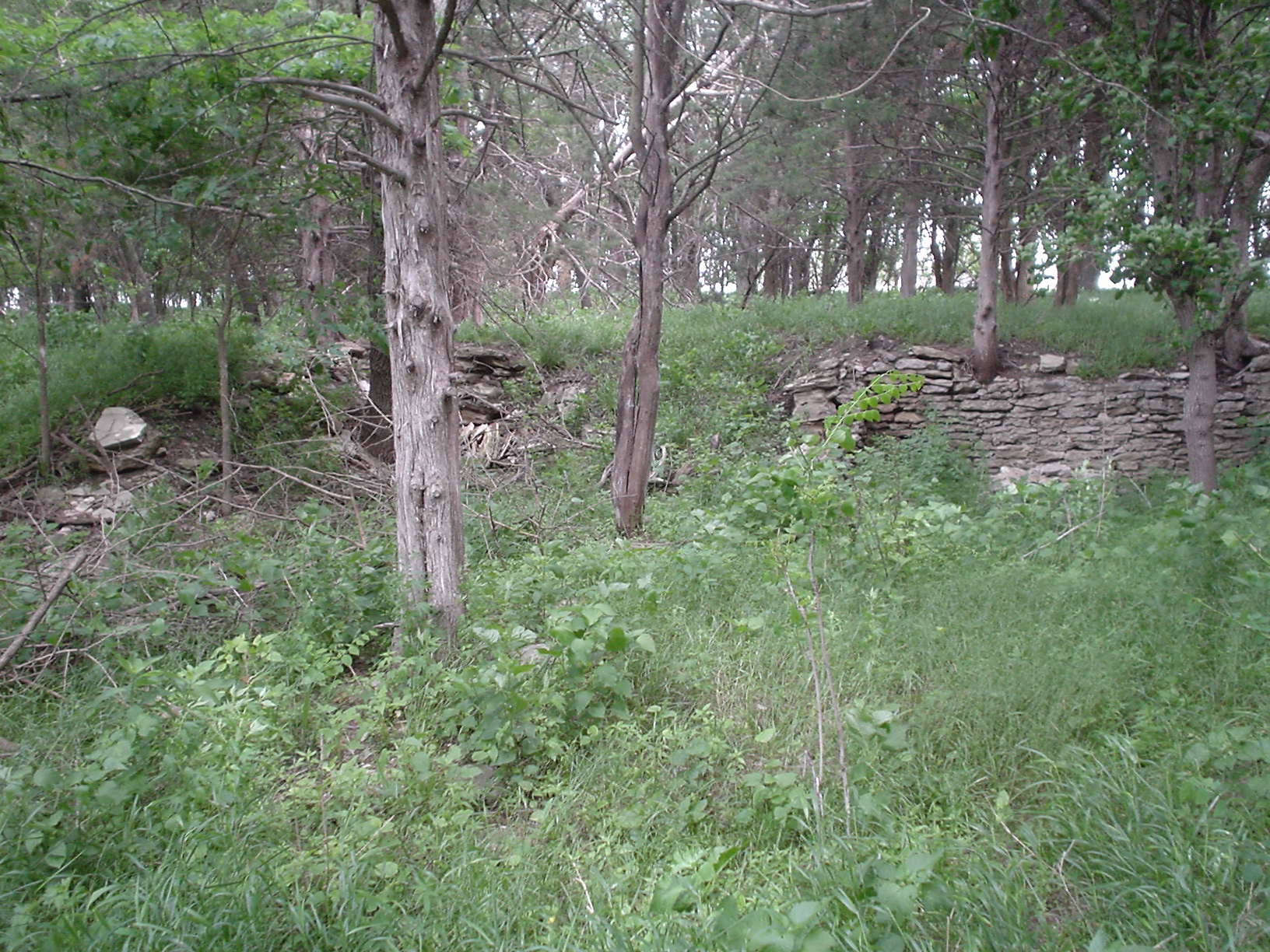
[Photo 48 – Stone foundation still visible]
[Photo 49 – Larger Reed home was situated in the trees]
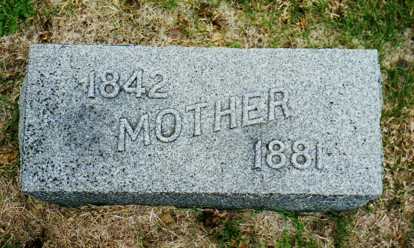
Eleven days after the birth of her fourteenth child, Ruth Ann disappeared in
August 1881.
MRS. REED FOUND -- The body terribly mangled by hogs.
Last Monday morning, September 19, 1881, the news came to our town, that the
body of Mrs. Reed, the wife of M. G. Reed, of South Branch precinct, was found
about 8 miles south of Syracuse, in a corn field. Repairing to the place
indicated we found the story too true. In Wm. Tangeman’s corn field in Osage
precinct, a little over eight miles south of this place, there lay the mutilated
remains of the unfortunate lady, who on the 21st, day of August last, in a
temporary fit of insanity, wandered from her home to die in a horrible manner.
Matthew remarried in 1884.
[Photo 50 - Elder Matthew Reed]
[Photo 51 - Mathew, youngest, born 1881]
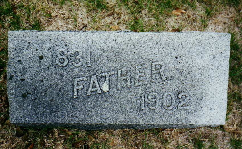
“Matthew Reed, died 15 August 1902, aged 71 years, died at his residence on the
Muddy Creek in South Branch precinct last Friday, and he was buried at Hopewell
cemetery Sunday. He leaves a wife and twelve children to mourn him.
“The deceased came with his brother, David, from Ohio and settled on the Muddy
Creek in 1861, and continuously lived in the county since. In the early days he
was county surveyor and a prominent man among Otoe county people. He leaves his
family in comfortable circumstances.
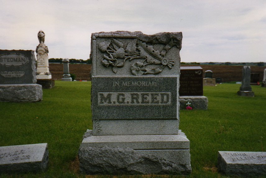
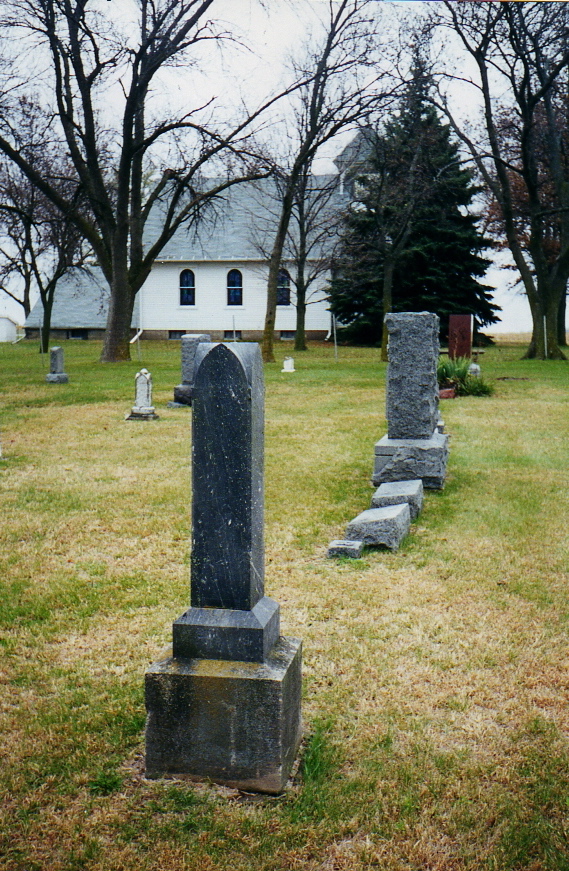
[Photo 52 - Reed Monument, Hopewell Cemetery
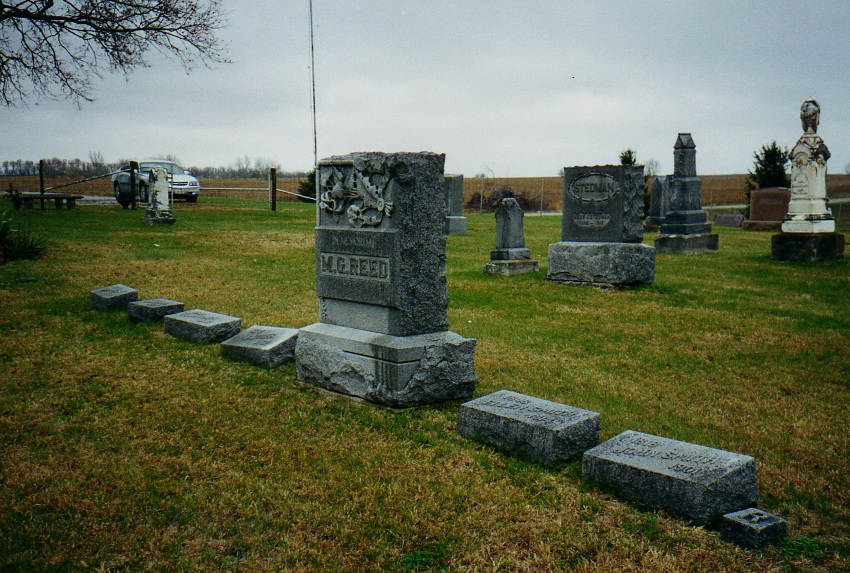
[Photo 53 - Reed Family Graves]
[Photo 54 - Matthew Reed Gravestone and Ruth Ann Gravestone]
[Photo 55 – Reed Descendants at Hopewell, Summer 2004]
Part 3 -George Washington Doane
George Washington Doane (#751) was a child of Joshua Doane and Rachel Hayden.
Joshua (#258) is the fifth descendant from Deacon John Doane. The lineage is as
follows: Deacon John, Ephriam, Ebenezer (1), Ebenezer (2) and Ebenezer (3).
Ebenezer Done (2) removed from the Cape to Maine about 1739. Joshua, the eighth
of ten children of Ebenezer (3) and Joanna Millet, was born 06 December 1807 at
either Canan or Lowell, Maine. Joshua married Rachel Hayden on 07 August 1833 at
Lowell, Massachusetts, Rachel was born 02 February 1813, at Corena, Kennebec
County, Maine.
They had possibly ten children of which George Washington was the third.
George was born on 04 December 1837.
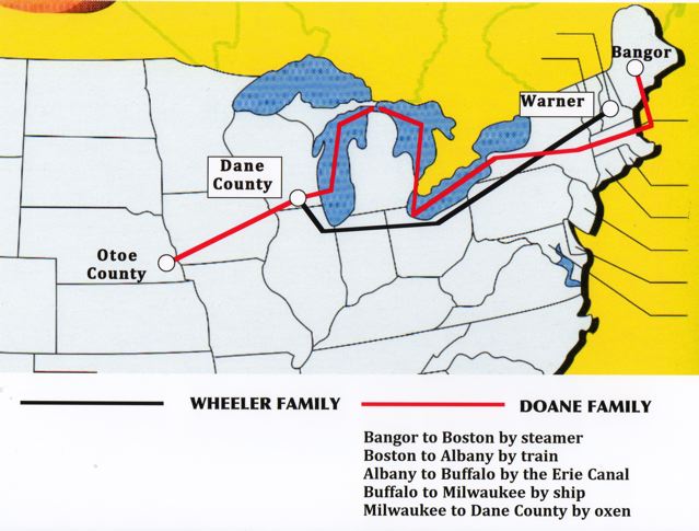
[Photo 57 - Doane Migration Map]
Joshua was a mechanic, but he never learned a trade. He had an iron constitution
and cleared up two heavily timbered farms in Maine. The family resided in Maine
until 1849, when the family removed to Dane County, Wisconsin. They made the
trip via steamer from Bangor to Boston, then by rail to Albany, then by canal to
Buffalo, then by the Lakes to Milwaukee, where they took an ox team and finished
the trip to Dane County. At that time this section of country was but little
improved, and most of the land was owned by the Government. As there were no
railroads, Milwaukee was the nearest market. They settled on a farm on Section
Two, Rutland Township, just east of Stoughton and south of Madison.
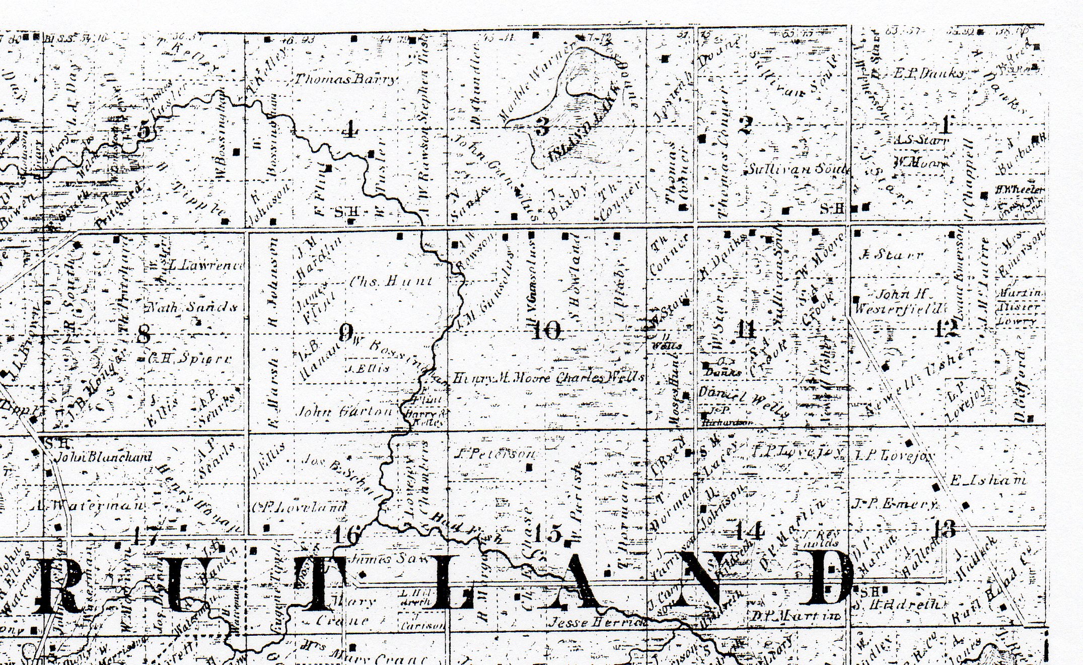
[Photo 58 - NW corner, Section 2 Rutland Township]
[Photo 59 – Joshua & Rachel at Riverside Cemetery Stoughton, Wisconsin]
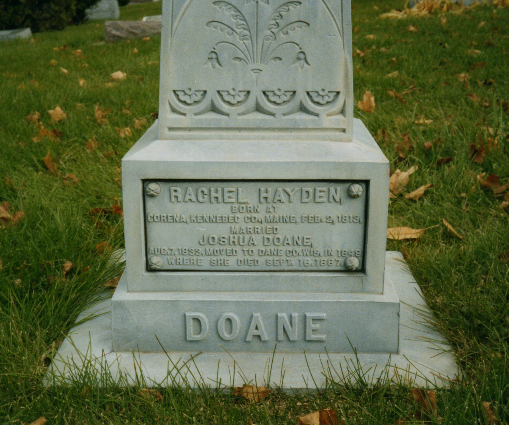
[Photo 60 – Joshua & Rachel at Riverside Cemetery Stoughton, Wisconsin]
Joshua died 20 March 1894 and Rachel 16 September 1887.
George attended common schools, and he spent his boyhood and youth after the
manner of most farmers’ sons, becoming familiar with the various employments of
rural life. Upon reaching his majority he began farming for himself not far from
the old homestead (farm).
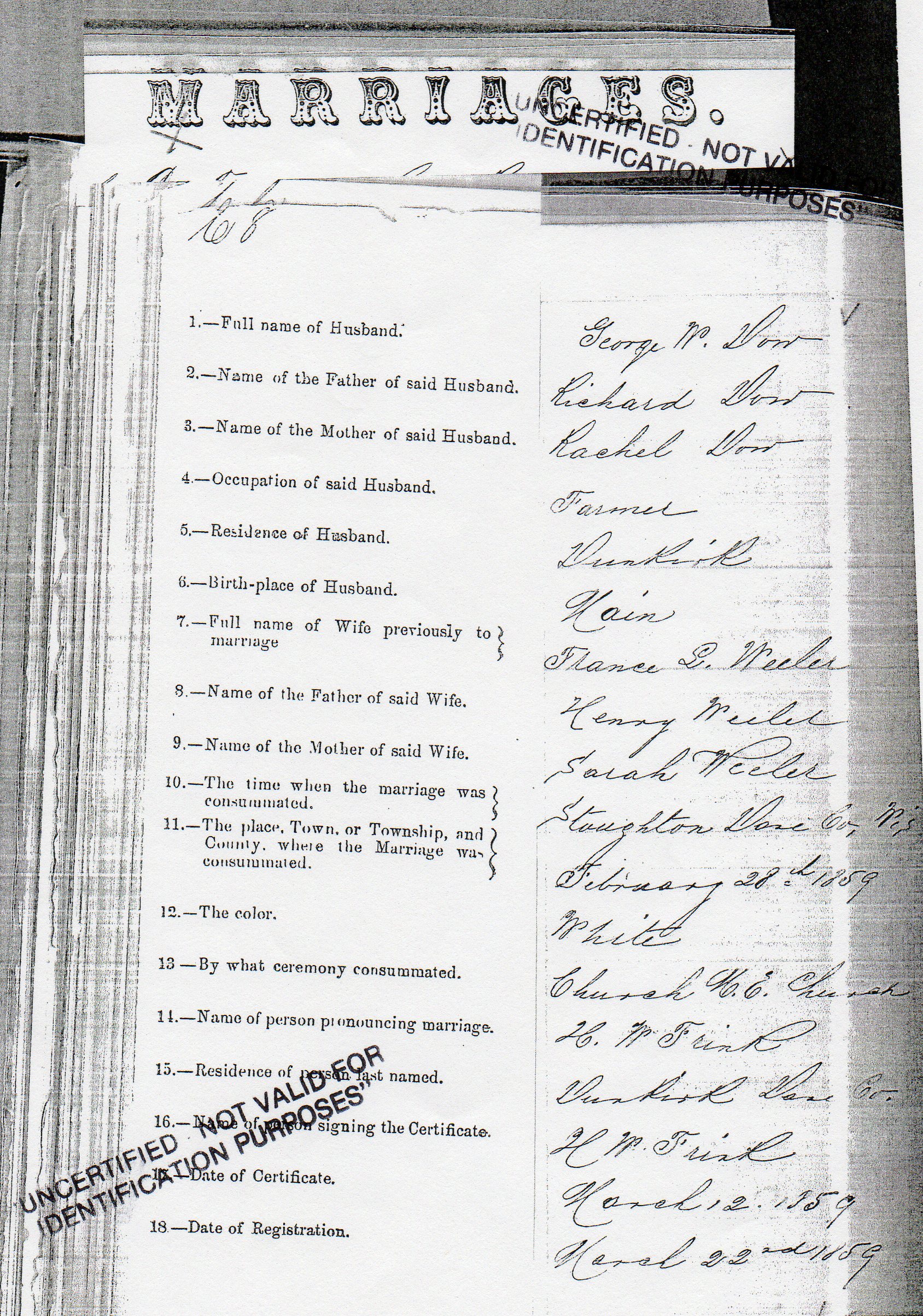
[Photo 61 – Marriage Record]
He married on 28 February 1859, at the age of 21, to Frances Lucinda Wheeler,
age 18, at Dunkirk, Dane County. Frances’ parents had removed from New Hampshire
to settle in Dane County in 1853.
Between 1860 and 1874 they had eight children. The first and second were born in
Dane County and the remainder were born in Otoe County Nebraska.
The family moved to where Unadilla, Nebraska now stands in 1865. They crossed
the Mississippi making the journey overland with teams, and homesteading 160
acres of land, settled upon it and began the improvements, which reflected in
such an admirable manner upon his industry and enterprise
George applied for a homestead, Application No. 746, at the Land Office at
Nebraska City on 16 February 1866. The total fee was $18.00. This homestead was
across the road from property owned by Mathew Gooding Reed.
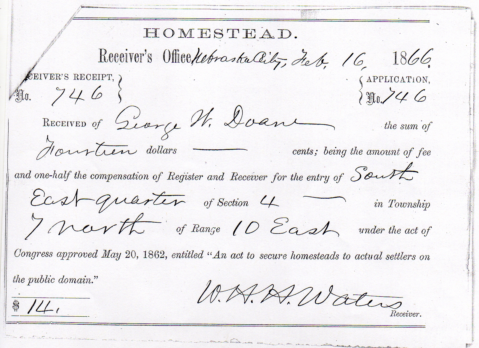
[Photo 62 – Application Receipt]
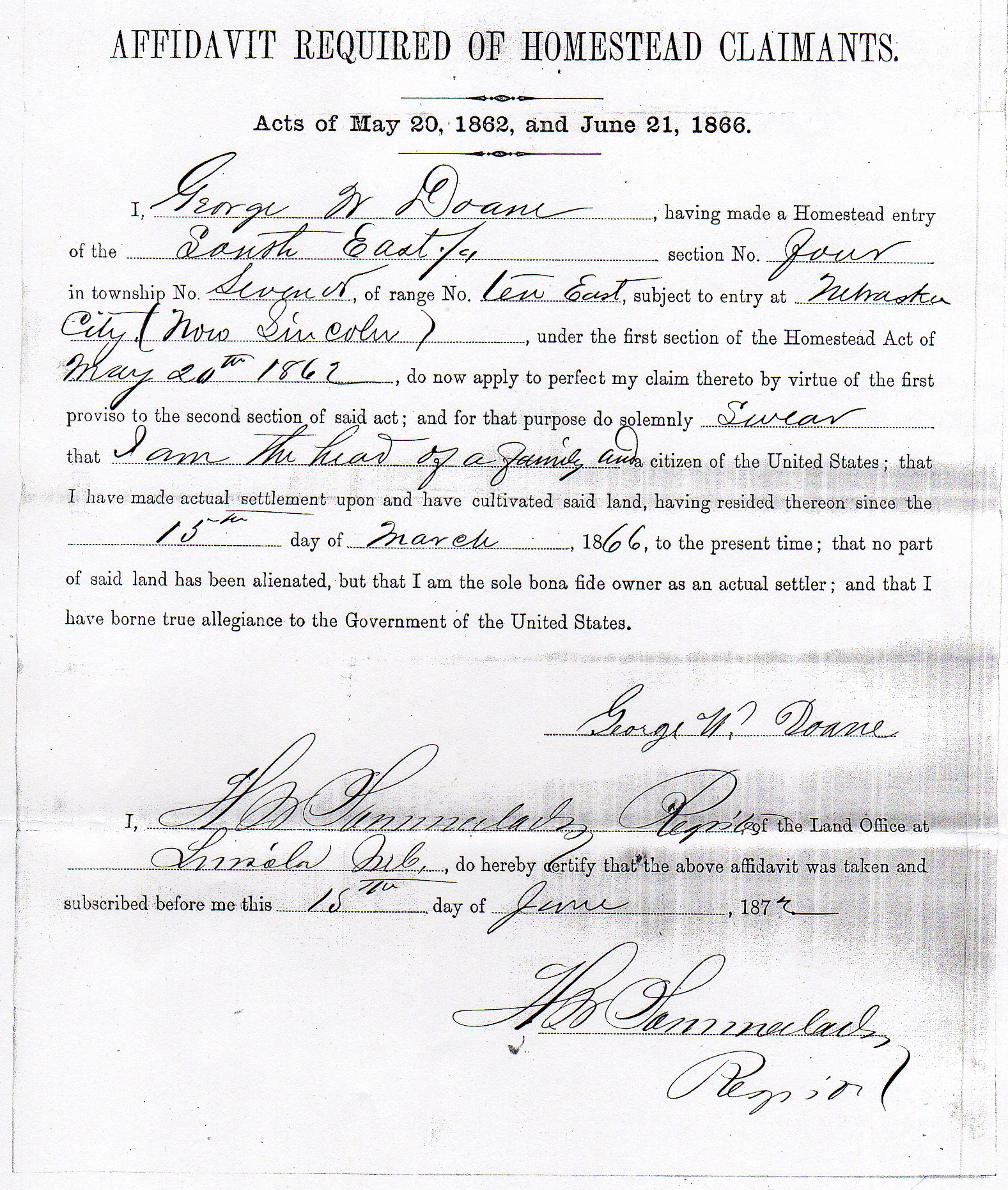
[Photo 63 – Affidavit]
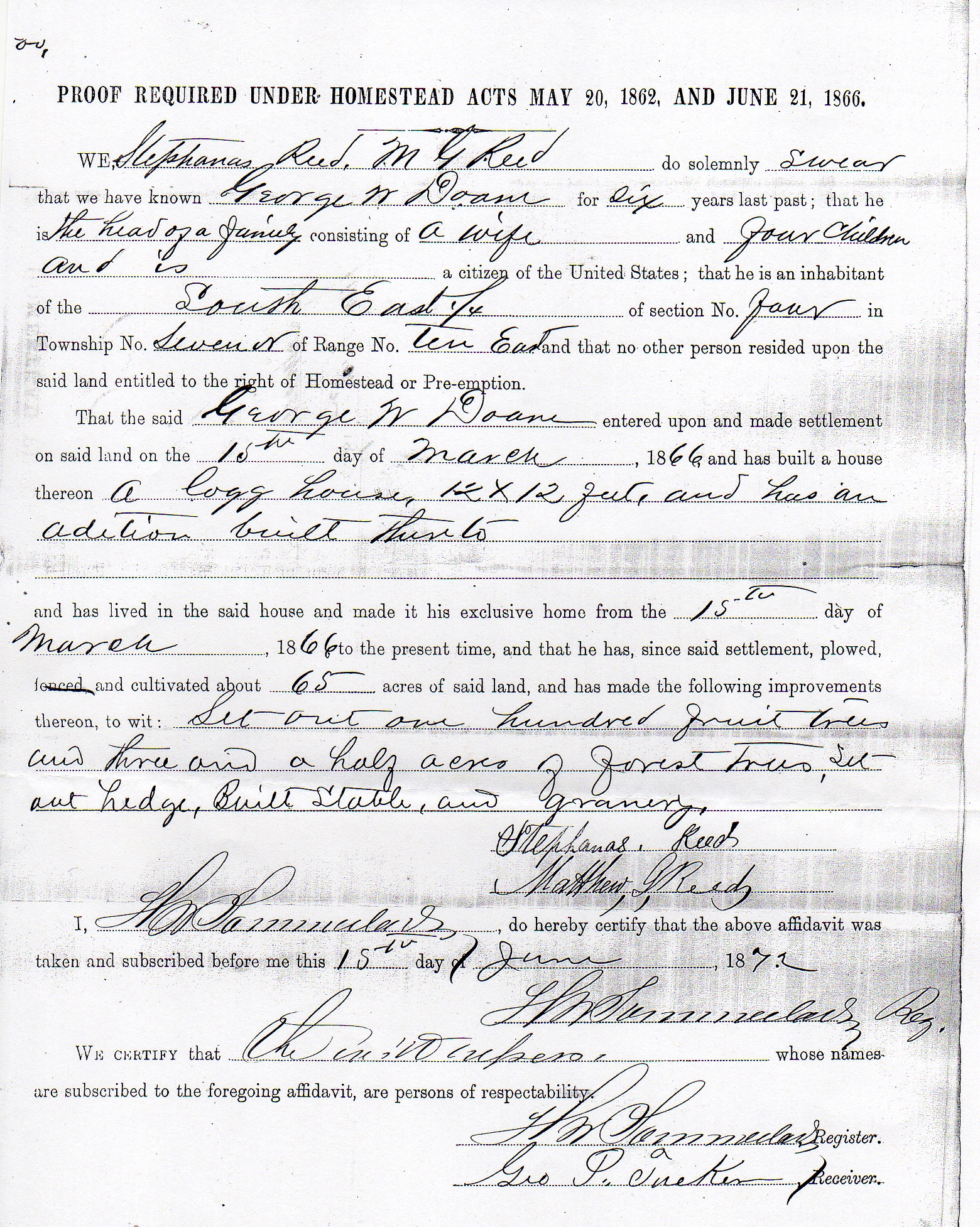
[Photo 64 – Proof of Compliance for Homestead Award]
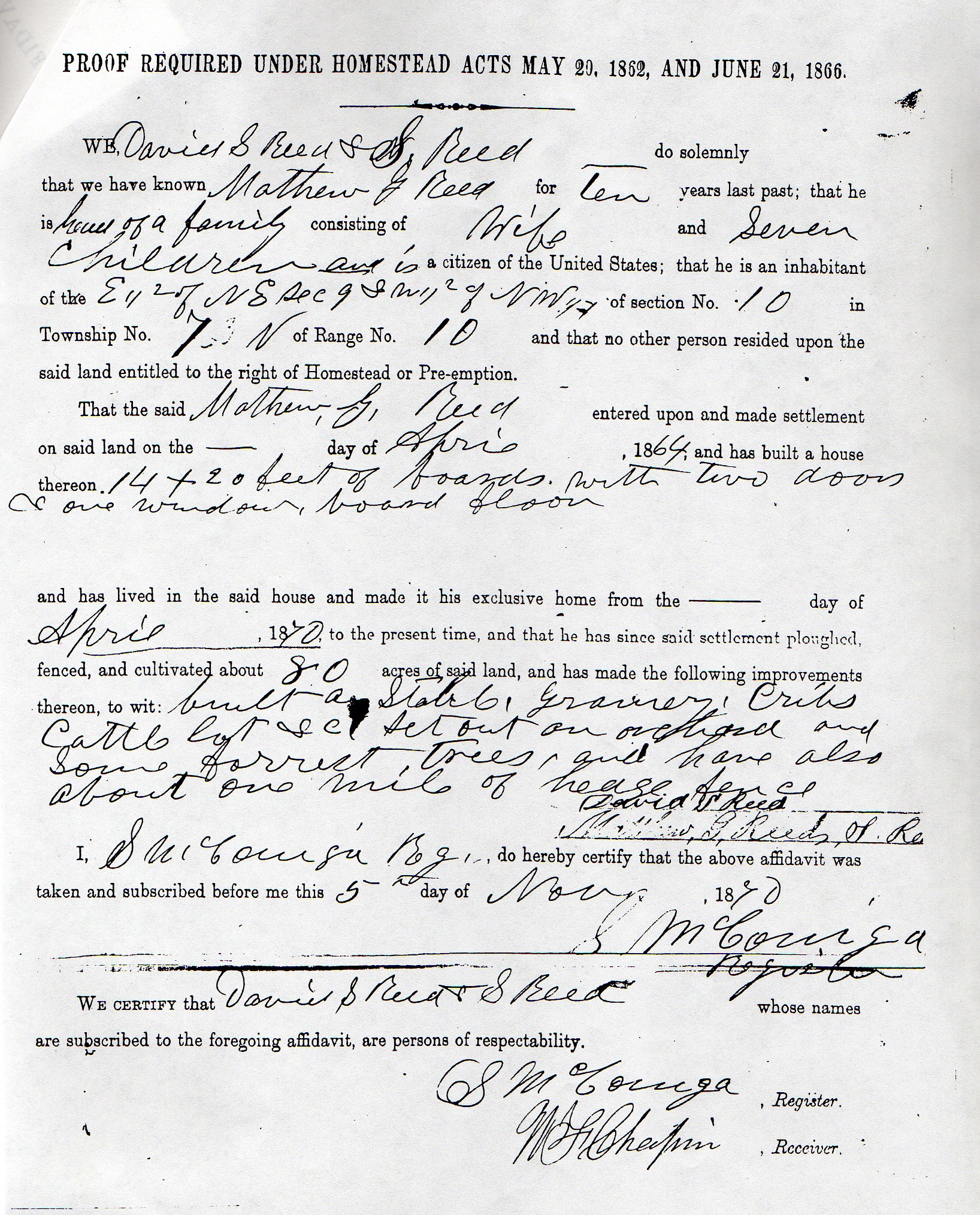
PROOF REQUIRED UNDER HOMESTEAD ACTS MAY 20, 1862 AND JUNE 21, 1866.
WE, Stephanas Reed, Matthew G. Reed do solemnly swear that we have known George
W. Doane for six years last past; that he is the head of a family consisting of
a wife and four children and is a citizen of the United States.
That the said George W. Doane entered upon and made settlement on said land on
the 15th day of March, 1866, and has built a house thereon a log house, 12 x 12
feet, and has an addition built thereto and has lived in the said house and made
it his exclusive home from the 15th day of March, 1866, to the present time, and
that he has, since said settlement, plowed, fenced, and cultivated about 65
acres of said land, and has made the following improvements thereon, to wit: Set
out one hundred fruit trees and three and a half acres of forest trees, set out
hedge, Built Stable, and granary.
George has brought the entire tract to a productive condition, planted a grove
of cottonwood trees, and has an orchard three acres in extent, besides the
smaller fruits. The land is watered by a living stream, (Muddy Creek) and
stocked with good grades of cattle, horses, etc. He purchased the additional 120
acres in the spring of 1883. He is fond of fine horses, and he has an interest
in the valuable full-blooded Norman “Romulus” imported.
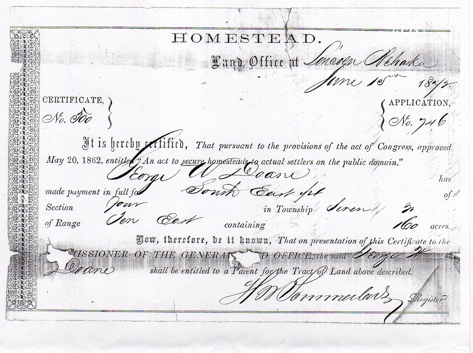
[Photo 65 - Homestead certificate]
Thus George secured a Homestead, Certificate No. 500, from the land office at
Lincoln, Nebraska. The certificate was delivered to him on 5 May 1873.
[Photo 66 – Location map]
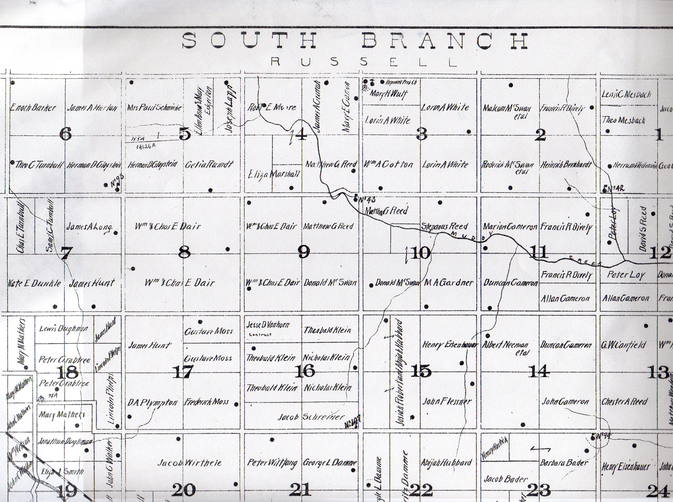
[Photo 67 – South Branch Township and Muddy Creek]
[Photo 60 – Aerial view]
“The George Washington Doane family, the third settlers of the area, were the
only family to use logs in the building of their home. A few years later this
home burned down and was replaced by the present house.
He was director of his school district, 1870-1874, with his Post Office address
at Nursery Hill.
The homestead of 160 acres of land was valued at $2,000.00, of which 50 acres
were under cultivation. His farm implements were worth $150.00. His livestock,
valued at $450.00, consisted of five horses, three head of cattle including two
milch (sic) cows, and three hogs. In 1869 he had raised 250 bushels of wheat,
100 bushels of corn, 80 bushels of oats, 50 bushels of barley, 100 bushels of
potatoes and had put up 10 tons of hay. The family also had sold 3000 pounds of
butter during the year.
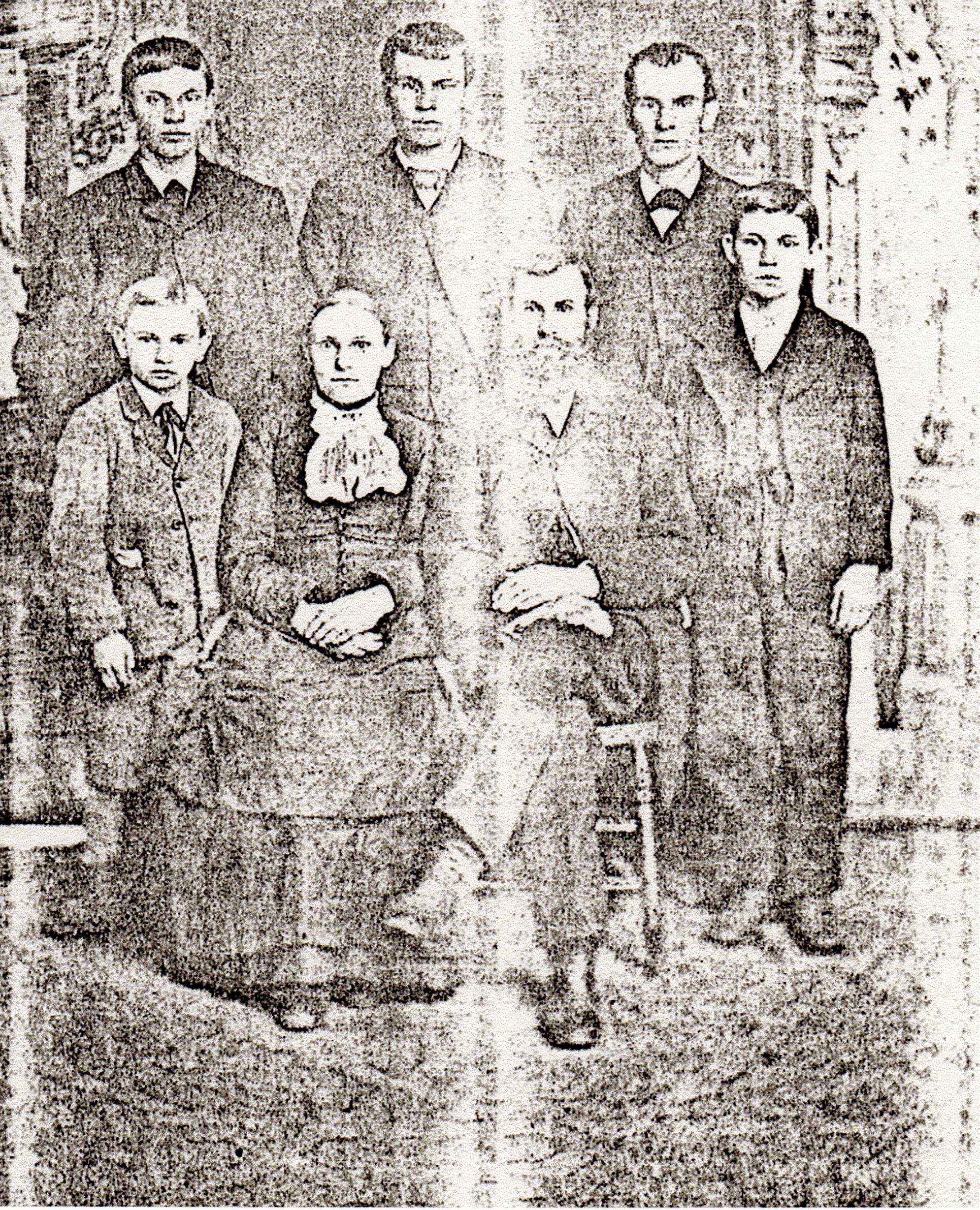
[Photo 69 – G. W. Family]
back row – Henry Elbert, Halsey Adalbert, and Arthur Nelson (Eunice’s Great
Grandfather)
front row – Charles Hiram, Frances, George, and George Elvah]
He purchased the additional 120 acres in the spring of 1883.
The farming and stock-raising interests of Otoe County have a lively
representative who now owns 280 acres of fine land on the southeast corner of
Section 4, South Branch Precinct. He evidently has made the most of his
experiences as an agriculturist, and in reward for his thrift and industry is
surrounded by all the comforts of life with many of its luxuries, and with an
ample competence for his old age.
Mr. Doane cast his first Presidential vote for Abraham Lincoln, and is an ardent
supporter of Republican principles. Both he and his estimable wife are members
in good standing of the Presbyterian Church, attending at Hopewell. Mr. D. has
been a member of the School Board since the formation of the district, and Road
Supervisor a number of years. He is warmly interested in the success of the
temperance cause, and a member of the society in South Branch. He has built up a
record of an honest man and a good citizen, one who enjoys in a marked degree
the esteem and confidence of his community.”
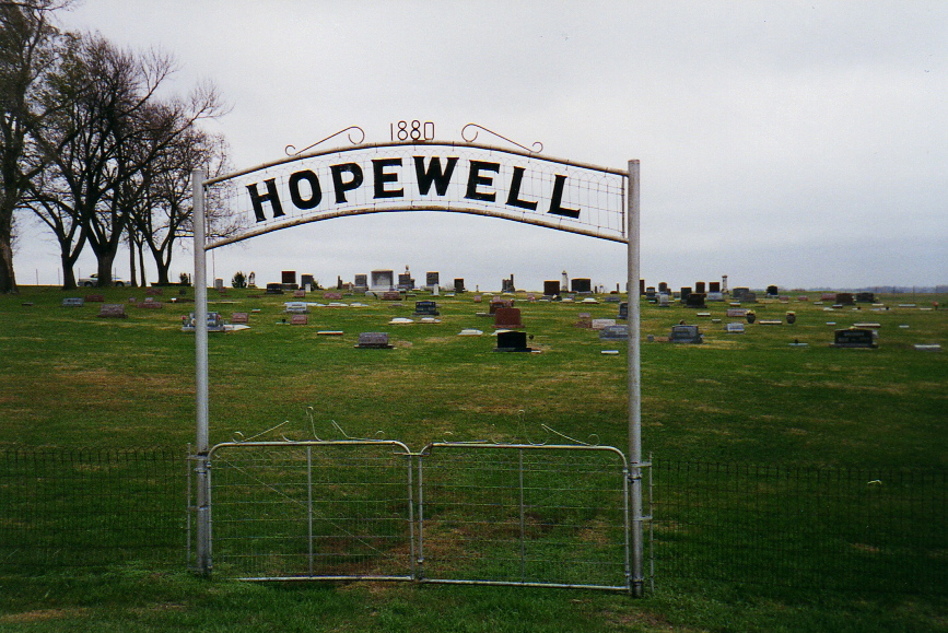
[Photo 70 – Hopewell Cemetery]
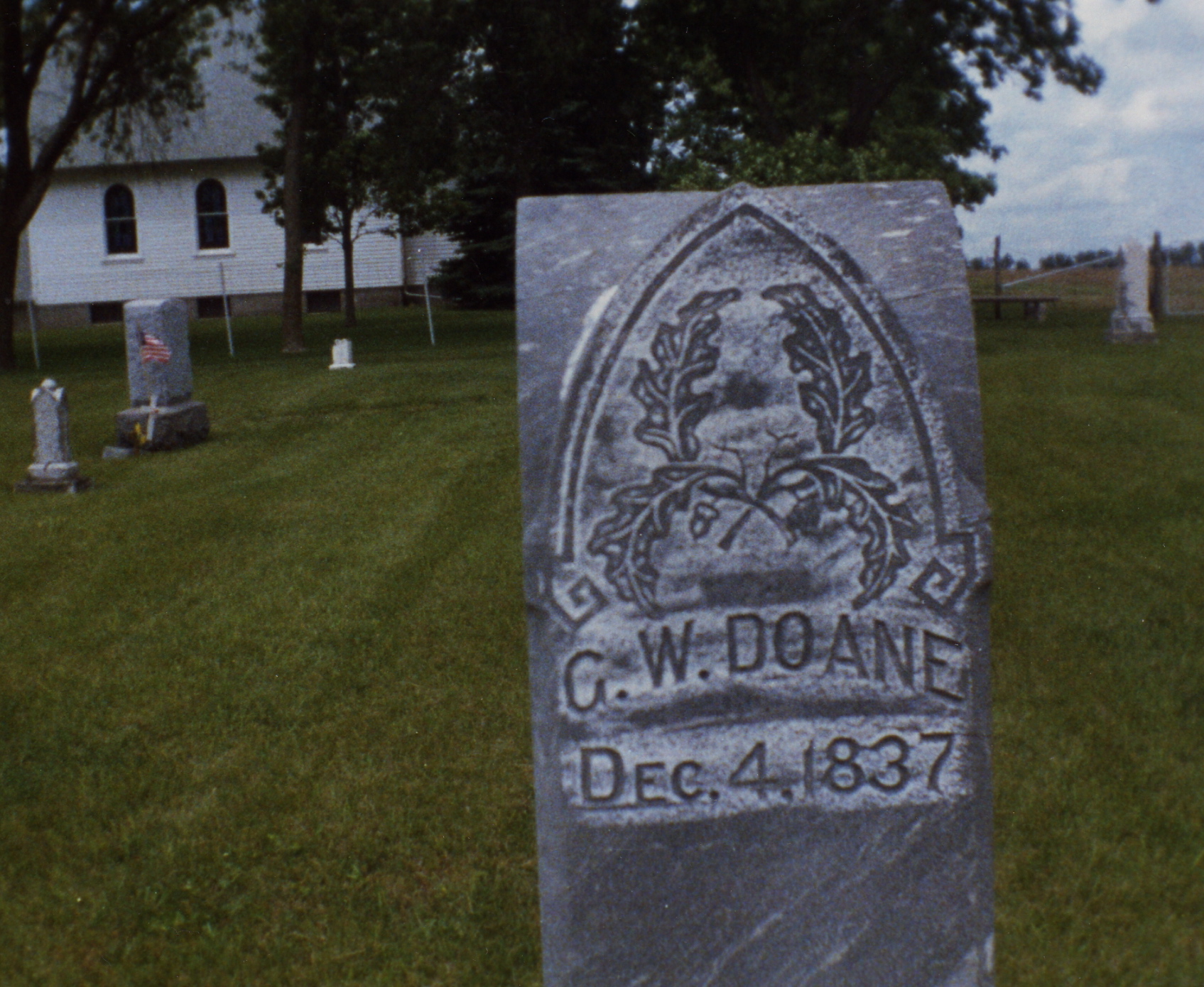
[Photos 71 – Doane Monument]
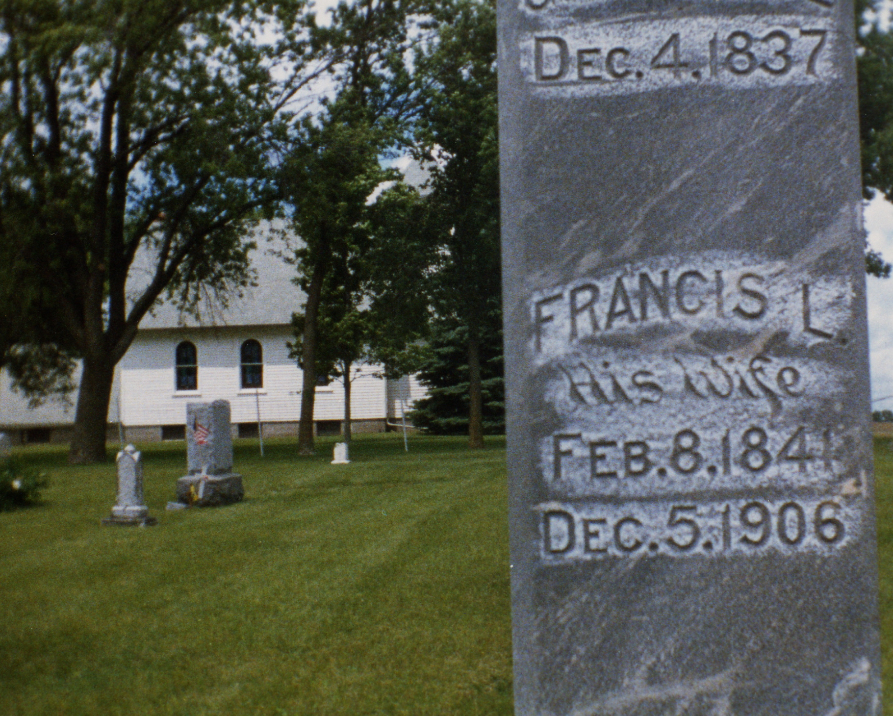
[Photos 72 – Doane Monument]
Frances Obituary
“Mrs. G. W. Doane died Thursday 05 December 1906, at her home in Hartington,
Cedar County (Nebraska), age 66 years. The family moved to where Unadilla now
stands in 1863 and lived there until twelve years ago when they went to Cedar
County. The remains will be taken to Unadilla for interment, funeral being held
in the Presbyterian church at that place.”
George Washington Obituary
“In 1894, Mr. Doane moved to Cedar County, Nebraska, where on December 5, 1906,
his wife preceded him into the beyond, since that time he has made his home with
Charles, at Cottonwood, South Dakota, until death called him hence, Oct., 14th,
1909, being at the time of his decease, 71 years, 10 months, and 10 days old.
“The body will be shipped and interment made in the cemetery of the Hopewell
church, in Otoe County, Nebraska, beside his wife.
[Photo 73 – Doanes adjacent to Reeds at cemetery]
Their first born, Arthur Nelson Doane (#918), Eunice’s Great Grandfather,
married Jane R. Reed on 25 December 1883, at the bride’s father’s home, Mathew
G. Reed. Officiating was T. D. Davis and the two fathers were witnesses.
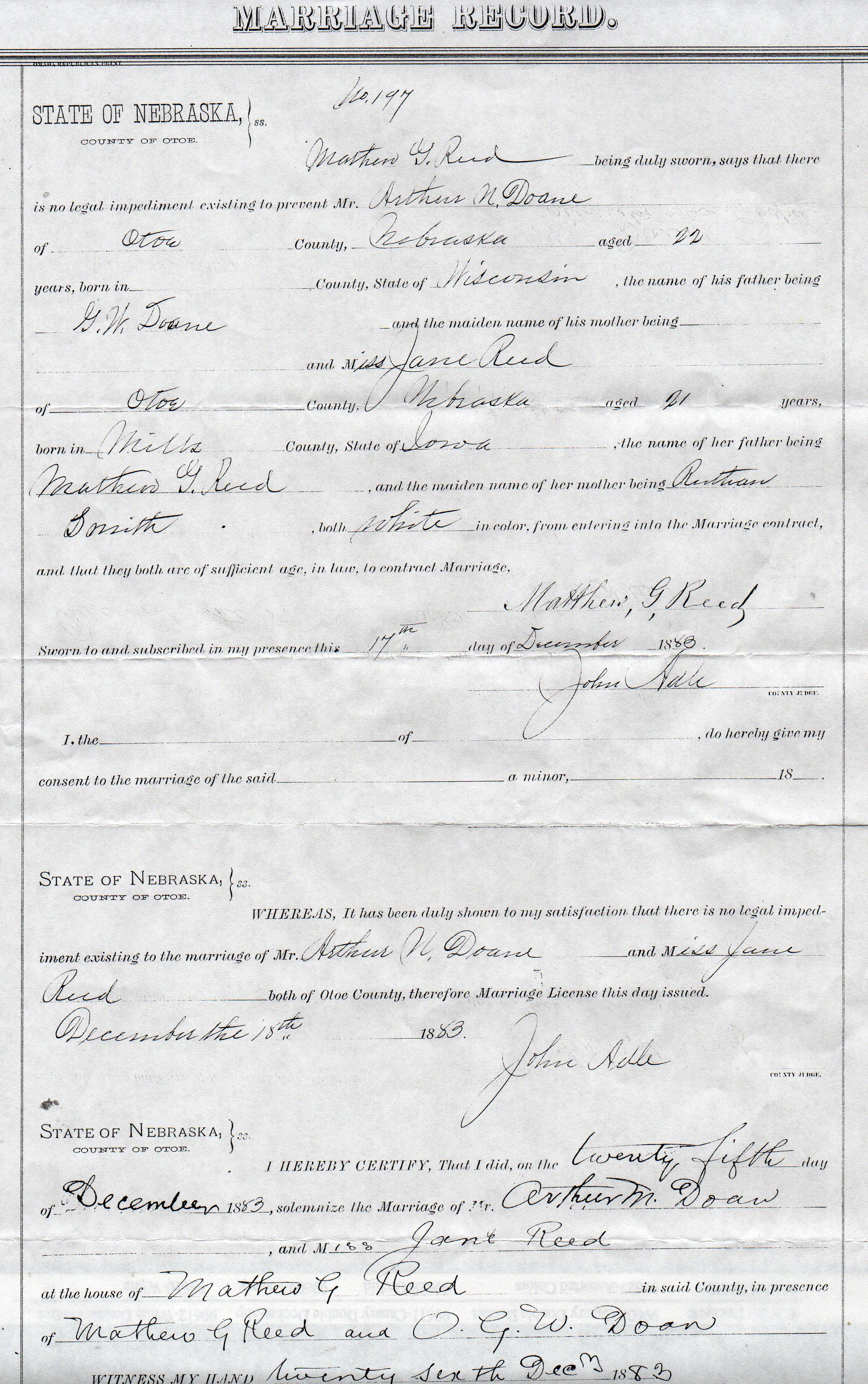
Photo 74 – Jane & Arthur - Marriage Application]
Matthew Reed being duly sworn, says that there is no legal impediment existing
to prevent Mr. Arthur N. Doane of Otoe County, Nebraska aged 22 years, born in
_______ County, State of Wisconsin, the name of his father being G. W. Doane,
and the maiden name of his mother being __________ and Miss Jane Reed of Otoe
County, Nebraska aged 21 years born in Mills County, State of Iowa, the name of
her father being Mathew G. Reed, and the maiden name of her mother being
“Ruthan” Smith, both white in color, from entering into the Marriage contract
and that both are of sufficient age, in law, to contract marriage.
Matthew G. Reed
Sworn to and subscribe in my presence this 17th day of December 1883
John Hale, County Judge
There is no explanation as to why Arthur’s mother’s name is not stated
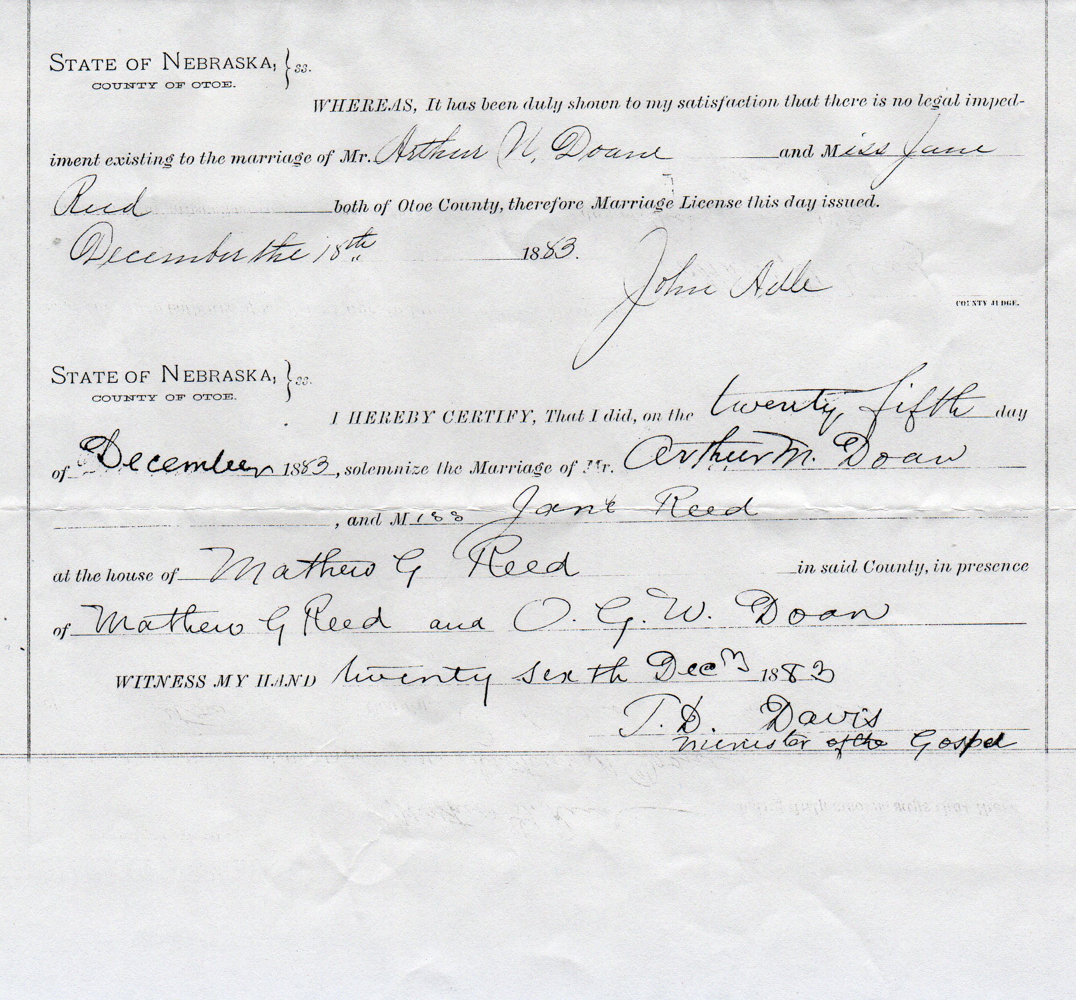
[Photo 75 - Marriage Certification]
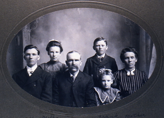
[Photo 76 – Jane & Arthur - Family Photo]
Alfred, Bertha (Eunice’s Grandmother), Arthur Nelson, Frank, Essie and Jane Reed
Doane.
Part Four - Life on the Plains
[Photo 77 – Homesteaders]
“These early settlers endured many hardships such as droughts, storms, and
grasshoppers. During the 1870’s the grasshoppers came. The men were in the field
harvesting spring wheat. The corn was good size. The grasshoppers left the
fields barren in a short time. They ate almost everything in sight, including
things made of wood, also clothing. When they had eaten their fill, they
departed, darkening the skies as if clouds had suddenly come between the sun and
the earth.
“Many Indians passed through on their way to Oklahoma Reservations. No trouble
was caused by them in this district. The women, however, were very much afraid
of them. Since the Indians knew this and liked to frighten
the women, many of the women dressed in men’s clothing and carried guns, while
the men were away.
“Stephanus Reed told of one occasion in which he met an Indian hunting deer. The
Indian seemed very friendly and gave three large chunks of the deer he has
killed. The Indian then asked him where he lived. Mr. Reed said “Oh up North a
ways”. Mr. Reed feared he might return in the night and attempt to steal
something, or attack him.
“He stayed on guard all night, but no Indians appeared. Because of various
encounters with the Indians, Mr. Reed has a habit of walking a short distance
and stopping and looking behind to see if he is being followed. He continued
this habit until he died -, which was many years after the Indians had been
driven out.
“The roads were mostly trails which followed fairly close to the creek. The
creeks were forded at convenient places. Most of these trails were feeder roads
connecting with the Oregon and Overland or Mormon Trails. Mr. Maller drove a
freighting wagon pulled by a team of oxen, between Nebraska City and Denver. He
undoubtedly crossed thru this District, since the Nebraska City cutoff was the
road he followed to connect with the Oregon Trail. He tells of encounters he had
with the Indians. Only three or four trips could be made during a year.
“Herds of cattle were also driven along these trails to markets, which were
located at St. Joe and Omaha.
“The oldest landmark was the Reed’s home. Here also was a tree planted by
Stephanus Reed, which he brought from Ohio, in the covered wagon.
1856 – cold hard winter followed two balmy spring-like winters
1859 – drought
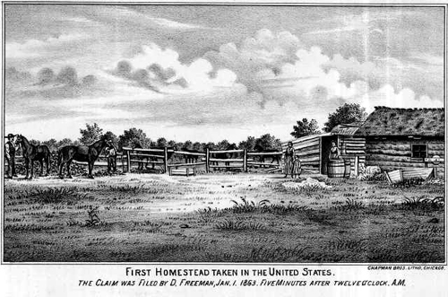
[Photo 78 – First Homestead]
1863 First Homestead – filed by Daniel Freeman, five minutes after midnight,
January 01.
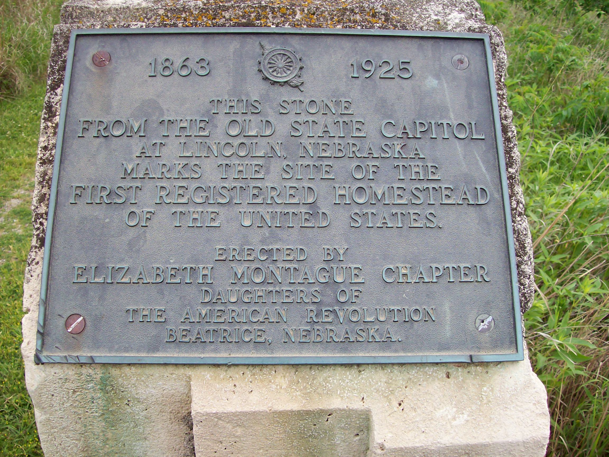
[Photo 79 – First Homestead Marker]
“This stone from the old state capitol at Lincoln, Nebraska marks the site of
the first homestead of the United States – erected by D.A.R. Chapter at
Beatrice, 1925”
Calendar of Events:
1869 - great storm
1872 – general store built at Unadilla, 6 miles to the north
1874 – people of Unadilla built a stockyard for the Burlington and Missouri
River Railroad. This was also the year of the locust invasion.
1876 – people of Unadilla built a railroad station.
1881 – Missouri River flooded
1888 - January – The Great Blizzard
1888 – Douglas (Hendricks) was founded five miles to the west
1913 – Tornado at Hopewell.
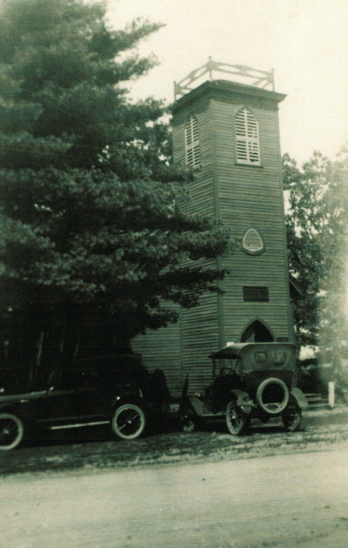
[Photo 81 - Hopewell Presbyterian Church before tornado 24 March 1913]
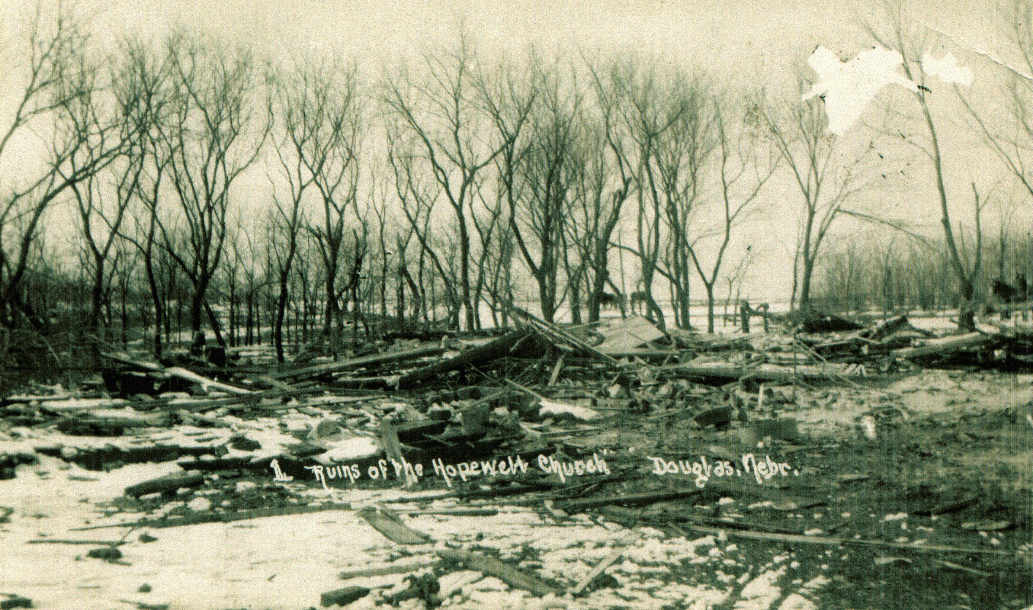
[Photo 82 - After tornado 24 March 1913]
This is a postcard photograph sent by a relative to my great grandmother Jane
Reed Doane then living in eastern Montana.
6:15 p.m. – Killed 18 – Injured 100 – 800 yards wide – Category F4

[Photo 83 - Hopewell Church 1997]
[Photo 84 – Homestead National Mon. Sign]
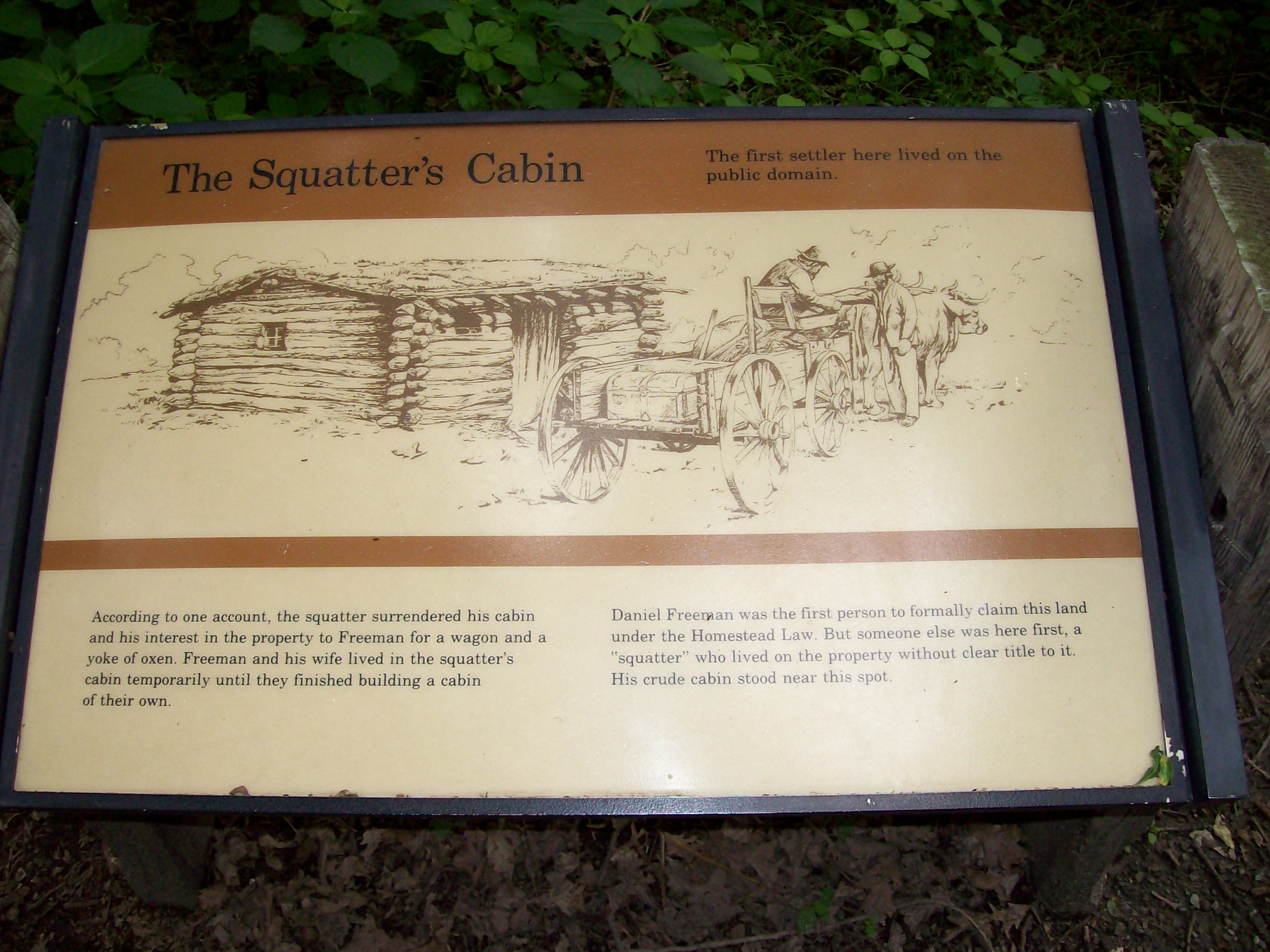
[Photo 85 – Squatter’s Cabin sign]
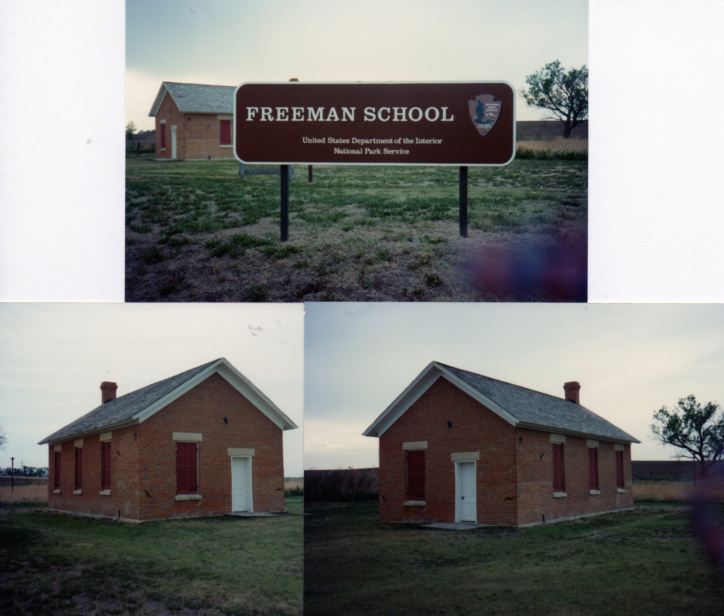
[Photo 86 – Freeman School]